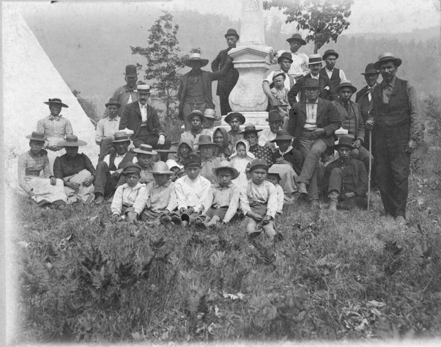
Land that changes hand in quiet offices, papers filed and stowed with no public fanfare. Check.
A culture that values privacy over commerce, tradition over publicity. Check check.
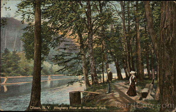
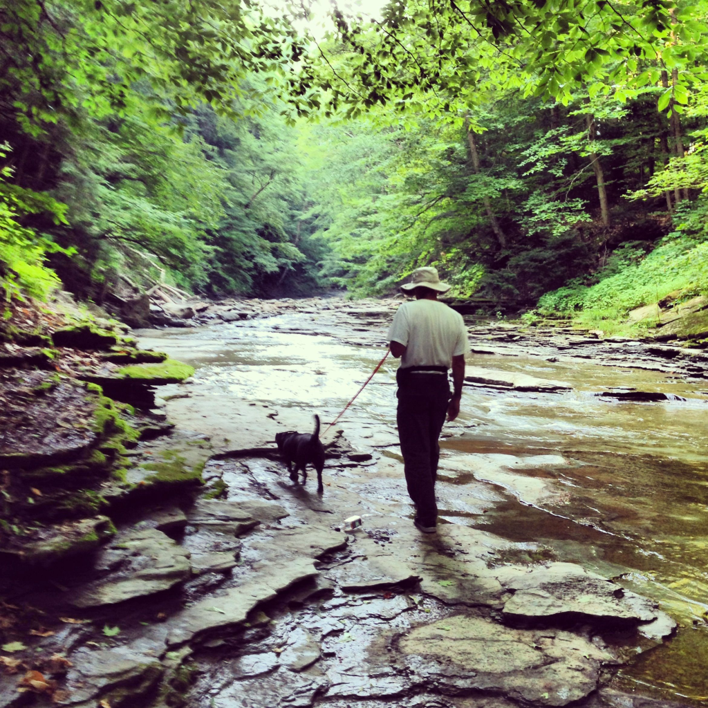
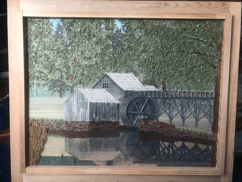
Allegheny River at Riverhurst Park Olean, NY
The Olean–Bayonne Pipeline was built by Standard Oil in the late 1800’s, America’s first long distance pipeline. It ran from Olean, New York, to Bayonne, New Jersey, through the middle of something called the Olean oil‑lease region. It had eleven pump stations approximately twenty-eight miles apart. It moved 50,000 barrels of oil a day.
It was abandoned in 1925, and that pipeline corridor left enough infrastructure to build a small city; construction camps, maintenance shacks and equipment, bunkhouses not on any official maps, known only through oral history and lore. These sites became known as the “lost camps”.
The Doctor’s Camp. A group of Olean-area physicians supposedly bought a secluded piece of land near the Allegheny and built a lodge that doubled as a retreat and a hunting base. The access road was gated, guests were vetted. No signage, no public listing. No patients, no families except on designated weekends, no uninvited guests, no business talk, no emergencies unless someone was actually dying. Fishing, bird hunting, poker, bourbon, and decompressing after 80‑hour weeks.
It was a private escape for professional men who wanted a place where no one could page them, call them, or ask them for a favor. The exact spot varies depending on who tells the story.
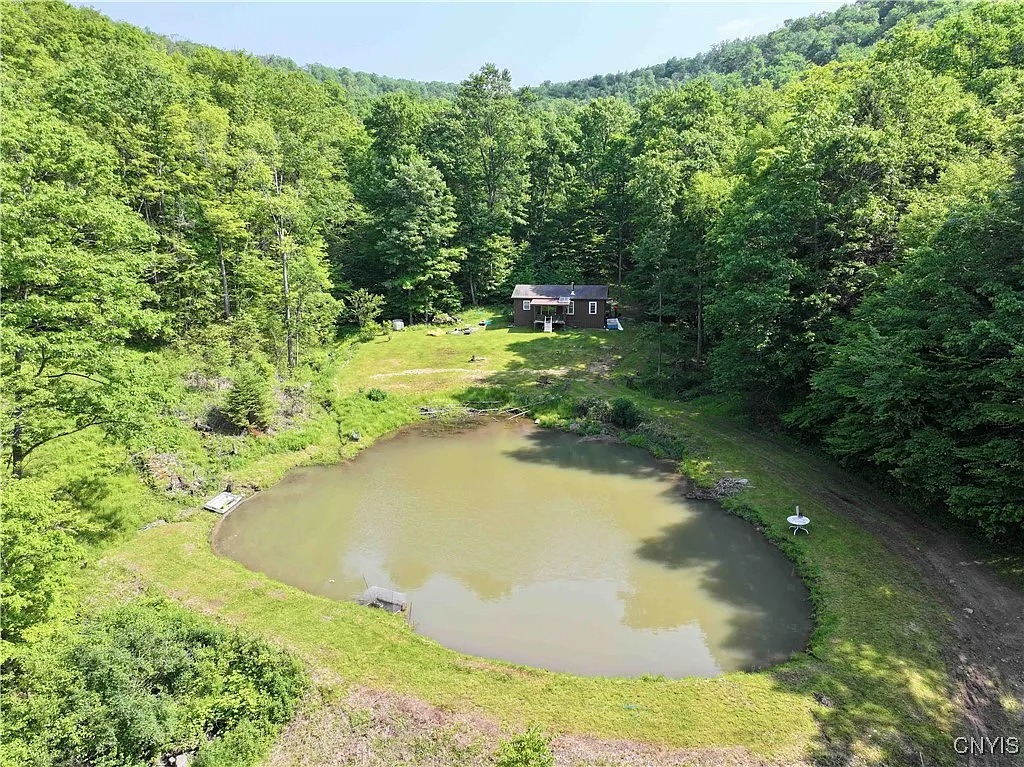
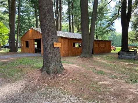
The Five Mile/Rock City/Windfall Camps. These camps flourished from the 1930s through the 1970s, tucked into the hills between Five Mile Road, Rock City Road, and Windfall. Several camps were owned jointly by small groups of Olean businessmen. No fighting, no politics, no bragging, no freeloaders, no showing up drunk, no bringing someone who would embarrass the group. Membership was capped, and vacancies only opened when someone died. New members were voted in, and blackballing was common. Outsiders could drive past the access roads for decades and never see a soul.
Secluded Camp Site in Olean, NY
The Hinsdale Ridge Catholic Camp. A group of Catholic families from Olean and Allegany supposedly maintained a ridge‑top camp that operated almost like a parish in the woods. Mass was reportedly said there once a year by a priest who was a member.
The Old Reservation Line Camp. This is the most mysterious of the bunch. It wasn’t owned by one group. It was used by Seneca hunters, white lease‑road workers, loggers, and sometimes mixed groups who respected each other’s presence. Don’t bring trouble, don’t disrespect the land, don’t cross the line without knowing whose land you’re on, don’t leave trash, don’t talk too loud about what you saw there. No one ever gave directions; you had to be taken there. It was said to be “neutral ground” where old friendships mattered more than land ownership.
The Lost Pipeline Camps. These camps were most likely forgotten Standard Oil construction camps, or pump‑station satellite camps, and the oldest of the rumored sites. Pipeline construction crews, maintenance men, and lease‑road workers built temporary shacks along the right‑of‑way, structures meant to last a season but were often used for years, rough‑cut buildings of tar paper and lumber, perched near the oil leases and close enough to the pipeline corridor that workers could reach it on foot, an accidental monument to the industrial age that had passed through the foothills. No road signs, no mailbox, no power, only reachable by a rutted track that looked like nothing. Hunters swore they saw lantern lights there in the 1960s, long after the original workers were gone.
Some locals believed the camp was still used once a year for a reunion, but no one could ever prove it.
These weren’t “secret societies, but they were closed circles — groups of men who built something together and kept it within the family. The Allegany foothills are perfect for this kind of lore. It’s the kind of mystery that isn’t solved — it’s inherited.
The Urban Legend is simple, and almost absurd. A man decides to build himself an island. He hauls rocks and fill onto frozen lake during the winter freeze (maybe more than one winter), dumping load after load onto the ice. When spring comes, the ice melts, the rocks sink, and the debris settles into a mound tall enough to crest the waterline. A private perch. A fishing platform. A tiny kingdom.
A Rock Island.
There are things buried in Chautauqua Lake, plenty of things. For instance, the Jamestown Water Works crib was built in 1885, a covered structure to supply Jamestown’s early municipal water system. It was 30 feet square, a tiny artificial island, timber‑framed, stone‑packed, and anchored offshore. It housed the intake pipe that fed the city’s pumps.
There are old steamboat moorings closer to shore; timber and stone structures used to anchor docks. Old ice-harvest platforms are out there; structures built on the ice that sometimes were left too long after the thaw, collapsed and left debris. Private duck blinds are buried in the shallows, built on pilings or rubble.
Docks and Wood Moorings in Chautauqua Lake
And there’s a Rock Island, an expanse of landfill spread over a few hundred square yards buried in the lower part of Chautauqua Lake that rises abruptly from the basin floor, where the water widens into a shallow, silty bowl. The United States Coast Guard Light List and Notices to Mariners does not map a named structure there, but they do show that the area is bordered by special‑purpose hazard markers. Sonar shows a steep‑sided mound with a flat top. That shape is the giveaway. It is not a natural shoal; the lower lake basin is too uniform, too silty, too geologically uneventful. It is not a collapsed crib; those leave rectangular footprints and predictable debris fields. It is not dredge spoil; dredging produces broad fans that spread with the current. It’s too far from shore to be a duck blind, or fishing perch. And it is not a remnant of the Jamestown Water Works crib, that structure sat further down-lake and was meticulously documented.
It is exactly the kind of footprint a failed island‑builder would leave behind.
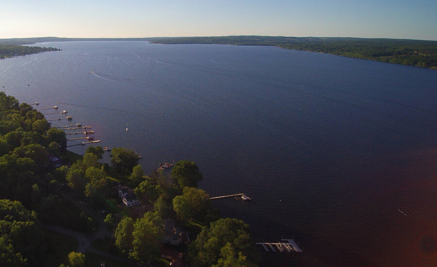
The Southern Basin of Chautauqua Lake
Boaters call it Rock Island, though no island ever broke the surface. It’s a relatively inexplicable phenomenon, a deliberate pile of stone, placed where no official record says stone should be.
The idea of an “Island Builder” is one of those half‑remembered Chautauqua Lake legends. Searches turn up no formal record, newspaper article, or historical entry about anyone successfully (or unsuccessfully) building an island on Chautauqua Lake. No Chautauqua County Historical Society archives mention a man attempting to build a rock island. No Post‑Journal or WKBW coverage (which would absolutely have covered a stunt like that) contains anything about a rock island project. No state, Corps of Engineers, or environmental reports mention any artificial island attempt on the lake, even a small, unauthorized fill would trigger regulatory attention.
The legend doesn’t include a timestamp, but it’s known that in the 1950’s through the 1980’s shoreline owners routinely dumped fieldstone, broken concrete, and construction debris into the shallows to extend their yards or build makeshift fishing perches. These projects were almost always unpermitted, short‑lived, and inevitably destroyed by ice; anything not heavily anchored with engineering rigor is crushed, shifted, or busted up and sent into the Chadakoin canal. Chautauqua Lake’s freeze–thaw cycles would have destroyed a small rock pile in one winter.
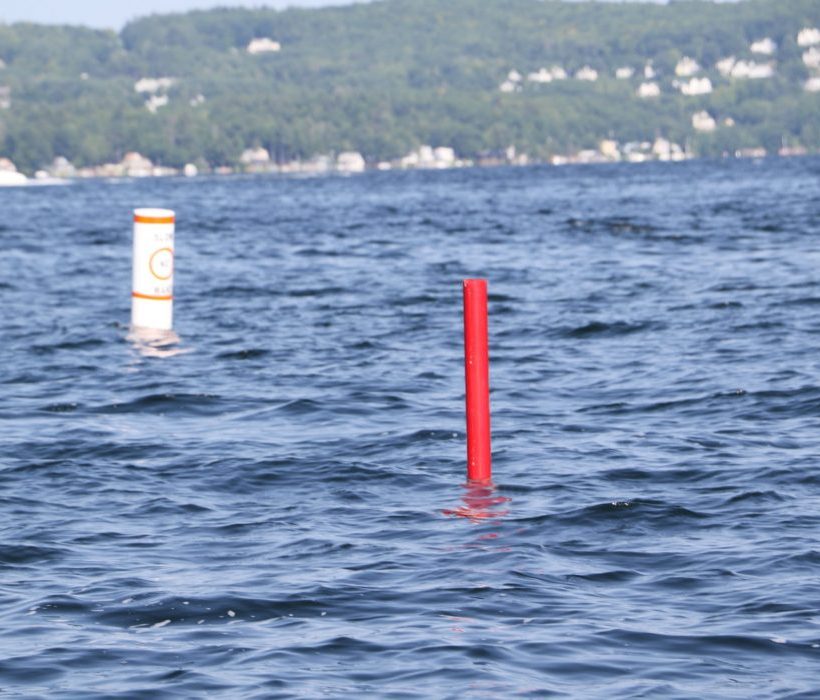
Buoys in the Lower Basin of Chautauqua Lake
The legend persists, not because it is proven, but because the lake itself seems to confirm it. The buoys float above a mystery that behaves exactly like the legend says it should. The hazard is real (as more than a few ruined propellers can attest). The mound is real. The absence of records is real.
When she blows it is a geyser of wood, iron, and human flesh spouting from the lake, reaching into the August sky, a China Syndrome meltdown of boiling water and steam that kills between five and eight people (steamboats are like busses, you pay your fare as you board) and ruins many more.
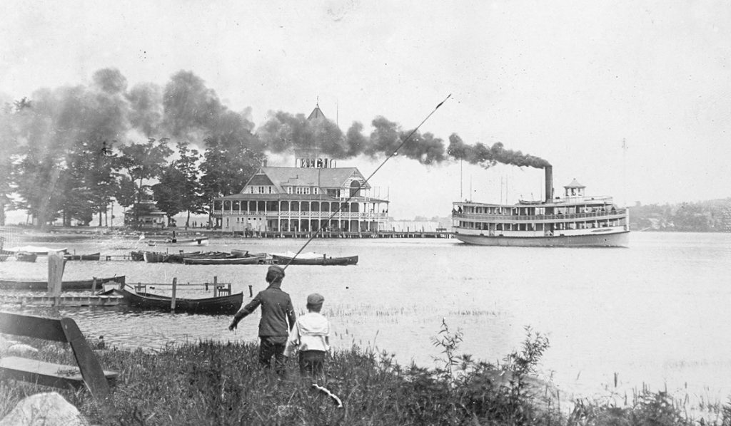
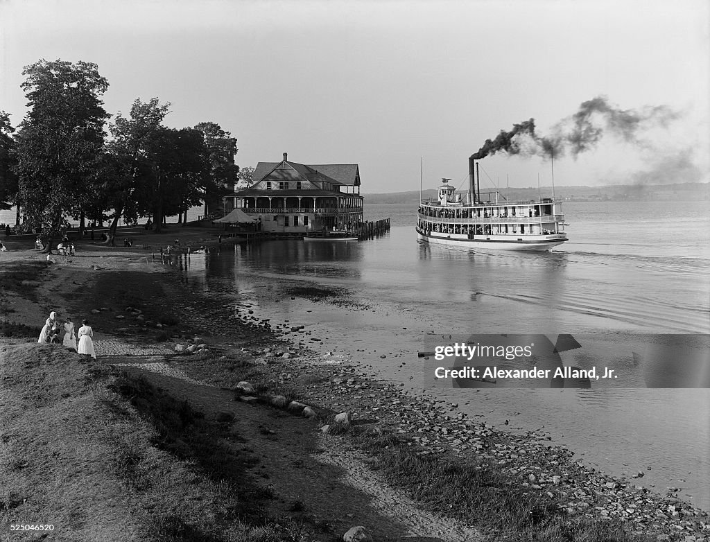
Steamboat service on Chautauqua Lake began as early as 1828. By the 1870s, it had grown into a regular, reliable system of travel, a transportation corridor before it was a recreation and entertainment resource; that designation began in the 1890’s when Celoron became “the Coney Island of Chautauqua”.
The lake WAS the highway in 1871. Roads from Jamestown to Bemus or Stow, on to Mayville, were rutted dirt horse-paths. If you wanted to move any significant quantity of livestock, mail, food, timber, or people, you did it on boats like the City of Buffalo, City of Chicago, City of New York, and City of Erie. Competition was fierce, and companies often upgraded engines, cabins, and décor to attract passengers. Consistency, timely delivery of patrons, keeping to a schedule was important to the lines.
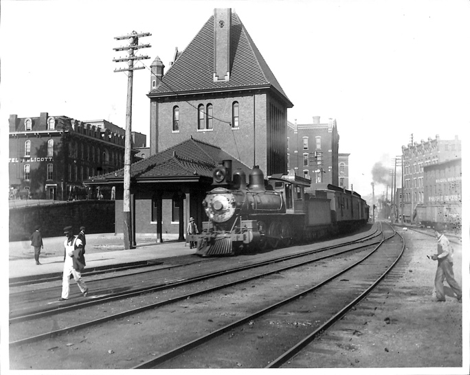
A man steps out of an Atlantic & Great Western Railroad passenger car at the station in Falconer, New York. In 1871, travelers going from Buffalo to Jamestown, ride the “A&GW” on a broad-gauge six-foot line, the only through service connecting Buffalo to the southwest most corner of New York (Buffalo to Hamburg to Gowanda to Dayton to Conewango to Kennedy, to Falconer).
Service on the Buffalo & Jamestown Railroad won’t reach into Jamestown until 1875. Freight interchange that far is limited because of the gauge mismatch, lines going into Jamestown are smaller at 4 foot 8 1/2 inches.
The first direct standard‑gauge rail line into Jamestown
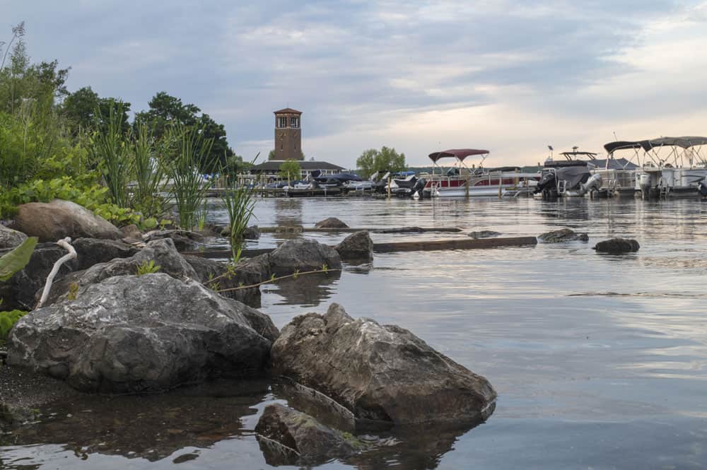
The man hails a carriage to Burtis Bay, named for settler Joseph Burtis -later the area is called Prendergast Point, eventually named Celoron when the city is incorporated in 1896.
The Docks at Celoron, New York
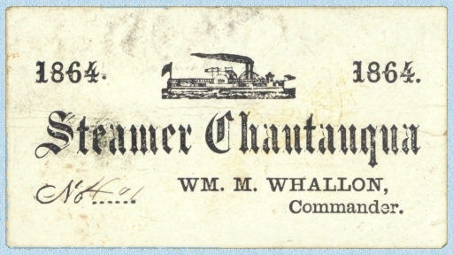
Despite temperatures near ninety degrees, he wears the dark frock coat and light patterned waistcoat of a traveling gentleman, checked trousers with suspenders. He tips his bowler cap to the ladies, checks his pocket watch and hurries to the docks. There he pays his thirty-five cents (an extra five cents for his traveling trunk) and boards the Steamer Chautauqua for a refreshing ride to the upper basin of the lake where he has a farming interest.
The sixteen-foot paddles of the side-wheeler steamer (twelve, five-foot tall buckets built into each) engage and the Chautauqua lurches forward, churning up soot and weeds from the shallow Chadakoin inlet.
A sixteen‑foot wheel on a 120‑foot boat is proportionally large, nearly 14% of the vessel’s total length. That size gives the Chautauqua strong thrust to handle the lake’s shallow, weedy conditions, and good maneuverability for short hops between landings.
It also puts a considerable burden on the boiler that powers the boat.
A young man climbs to the main deck to get some air. He’s just finished feeding the boiler, third load of wood in the last half-hour on orders from the captain. This captain likes speed, likes being ahead of schedule.
It’s too much wood in the young man’s opinion, runs the boiler too hot, but he isn’t about to contradict the captain, this only his second week on the job as boilerman on The Steamer Chautauqua.
The Chautauqua was retrofitted the beginning of summer, 1871, when the Chautauqua Paddle Wheel Company took ownership of her. New paint, new benches for passengers, a new hurricane deck, and a new boiler. New boilers need to be broken in, tested against the haul of the paddle in different conditions, heat levels meticulously maintained and monitored to see how the steamboat reacts and responds. The new boiler on The Chautauqua is no exception.
Except with the summer season here there’s money to be made, people need transportation up and down Chautauqua Lake. They can’t wait -won’t wait- for a boiler to be tested. Sometimes, those concerns outweighed safety protocols, and that could prove to be catastrophic.
As the young, inexperienced (cheap summer labor), boiler boy stands on the deck, sucking in the humid August air, something is happening three decks below.
PART II
Steamboat service on Chautauqua Lake began as early as 1828. By the 1870s, it had grown into a regular, reliable system of travel, a transportation corridor before it was a recreation and tourist resource.
The Steamboat Chautauqua lurches from its moorings in Burtis Bay (ne Celoron) and chugs into the lower basin of Chautauqua Lake. The captain is anxious to make good time and calls down to the boiler room for more power.
The Steamer Chautauqua Loaded for the Trip Up-Lake. To increase speed, the boiler crew throws in a heavy charge of wood. This spikes the furnace temperature. Pressure begins to climb faster than usual.
A gentleman watches a young man spring from the engine level onto the hurricane deck. The teenager sucks air and leans over the rail.
“Hot down there?” The man lights a pipe.
“Yes sir. We’re running a new boiler and the captain wants speed.”
“Makes for a nice breeze.”
“Yes sir,” the young man frowns, gazes at the shoreline. “Speed means a hot boiler though.”
The Chautauqua pulls into the narrows at Bemus Point. Farmers and merchants disembark. Mail bags and crates of produce are unloaded. Seven cords of lumber are dropped off while passengers board for the next leg of the trip to the northern basin of the long lake at Midway.
The Steamer Chautauqua Pulls into the Docks at Bemus Point
The sixteen-foot-tall paddle wheels idle in the shallows. A young man approaches the captain.
“Sir, when we sit still the boiler runs very hot.”
“That’s good lad. Plenty of steam to finish the trip to Mayville. We’ll break our own record! Hold until we depart and load the rest of the wood into her.”
“Aye aye sir.” The boy heads back belowdecks, shaking his head.
A gentleman overhears the conversation, watches the boy return to the boiler. He collects his traveling trunk and moves to the stern.
LAKE AND STEAMER, CHAUTAUQUA.PHOTOGRAPH C.1900. (Photo by �� Photo Collection Alexander Alland, Sr./CORBIS/Corbis via Getty Images)
The Steamer Chautauqua Departs Bemus Narrows
The waterline on the new boiler behaves differently than the old one, and the engineer on duty misreads the pressure gauge.When pressure rises to this level, the pump can’t keep up feeding cool lake water into the boiler. The crown sheet, the top of the firebox, overheats.It goes from hot, to red‑hot, to soft. Pressure rises above the boiler’s comfort zone. The overheated crown sheet is now the weakest point in the system.
Pressure spikes as The Chautauqua rounds the tip of Long Point.
A surge of water kicks up from the punishing paddle wheels, splashes onto the red‑hot crown sheet, the hissing can be heard on the main deck. There is an instant of flash‑steam, and the softened crown sheet collapses.
A gentleman at the stern of the Steamer Chautauqua hears a hissing from below-decks. He removes his jacket and waistcoat. He puts his wallet, papers, and pocket-watch in his luggage trunk, hoping it floats.
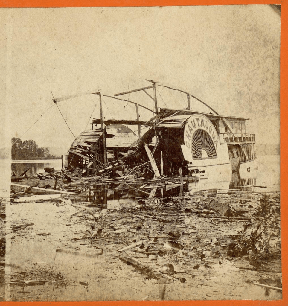
Just past Prendergast Point with the shoreline sliding by and passengers relaxing on the upper deck, the boiler shell ruptures. A blast of superheated steam, shrapnel, and scalding water rips upward and outward. The explosion makes a violent tearing sound.
Passengers on the upper deck are thrown into the air. The pilot house collapses. The midsection of the boat disintegrates, and a column of steam and smoke shoot straight up like a geyser. The paddlewheel jams. The Chautauqua begins to list immediately.
A gentleman waits a beat, then two. Then he tosses the trunk into Chautauqua Lake and follows it into the warm summer water.
Passengers are thrown into the water where they cling to floating wreckage. The stern stays afloat, but the bow is a splintered ruin.
Nearby fishermen and rowers rush toward the screams. Boats from Long Point reach the wreck within minutes and pull in the burned, the stunned, and the bleeding.
Several passengers never surface.
The wreck settles into the water. The stern remains afloat, typical for wooden steamers. The bow is a shattered ruin. The lake is a boiling, smoking patch of chaos.
Aftermath
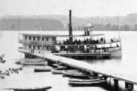
The Chautauqua was towed back toward Mayville. The newspapers called it “the most dreadful calamity ever known upon our lake.”
The Wrecked Steamer Chautauqua
The final toll varies depending on the source, between five and eight dead, many more injured. For a small community in 1871, it was a staggering blow.
The Chautauqua is the only major boiler explosion on the lake’s record.
“In the world of Stones, every landscape is a canvas for adventure. From the soft, shell-strewn sands of beaches to forests blanketed in pine needles and twigs, to the manicured charm of mowed meadows and diverse soil terrains – diversity is our playground. We embrace the unconventional, where slopes, hills, and rugged cliffs become the backdrop for an exhilarating Stones experience.”
Stones Throwing Association Website
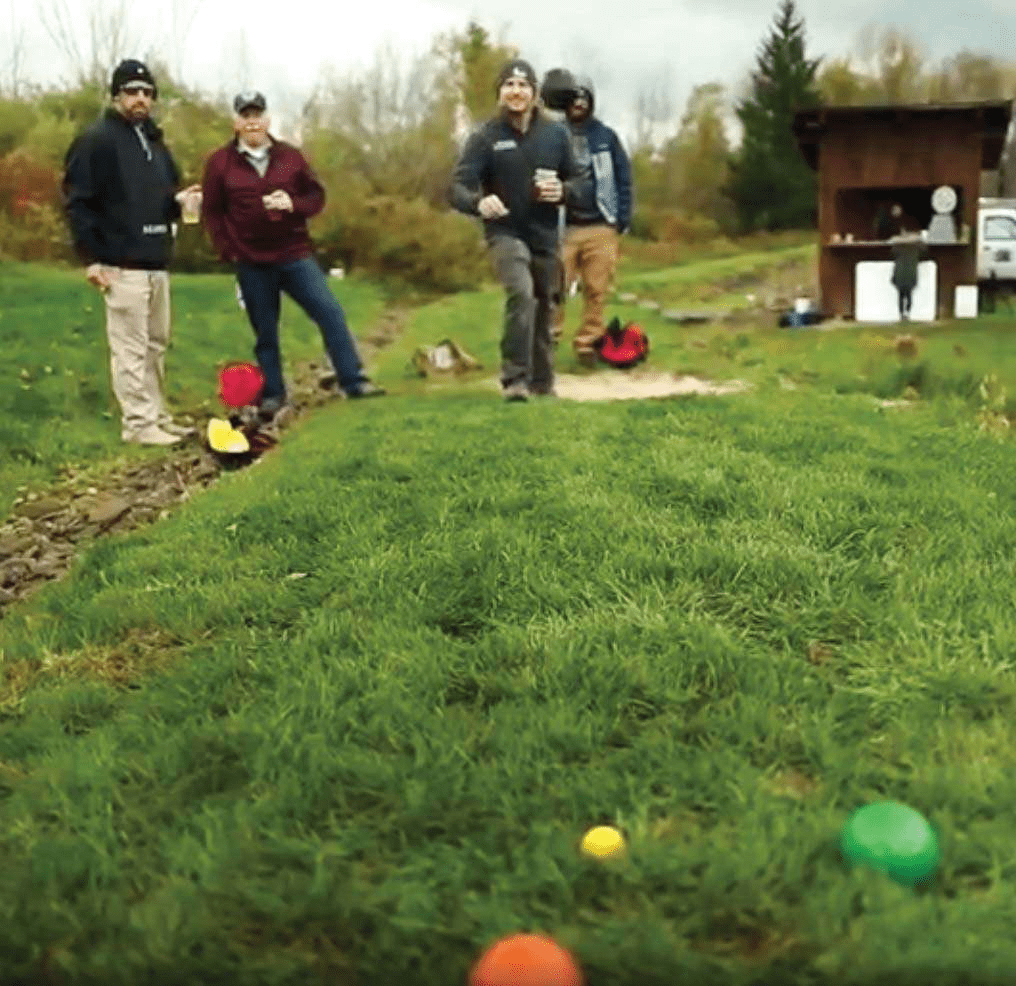
The game of Stones is easy to describe and hard to picture. The nearest recognizable relative is probably bocce; a small ball is set on a fixed piece of earth, and alternating competitors toss heavy baked-clay balls at the target, trying to get closest. But it’s like bocce in the same way shuffleboard is like golf.
So, Stones is more like golf? Not exactly. It has elements of golf, in that there is a fixed course, with fairways and hazards, out of bounds, and management strategies. But it’s more like putt-putt blended with bowling than the golf you know.
Kade Sivak is the COO of the Stones Throwing Association and manages the course located at the Southern Tier Brewery in Lakewood. It’s a unique recreation operation in Chautauqua County. He says about the game, “What I love most about the game is that it’s accessible, it can be played by people of all ages and still have a great time. We’ve had a tournament where we have an eight-year-old partner with an eighty-year-old and they ended up winning a few games and had a great time.”
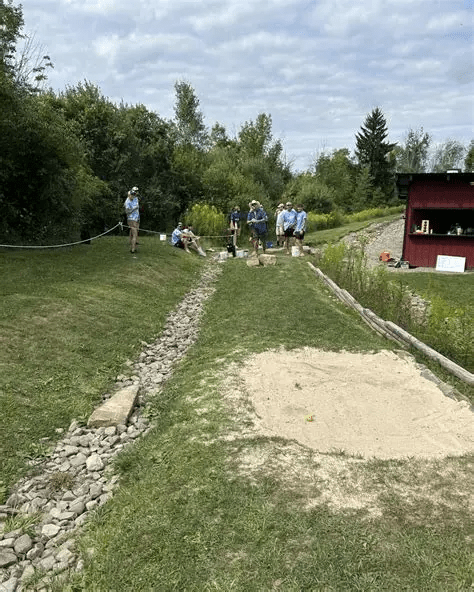
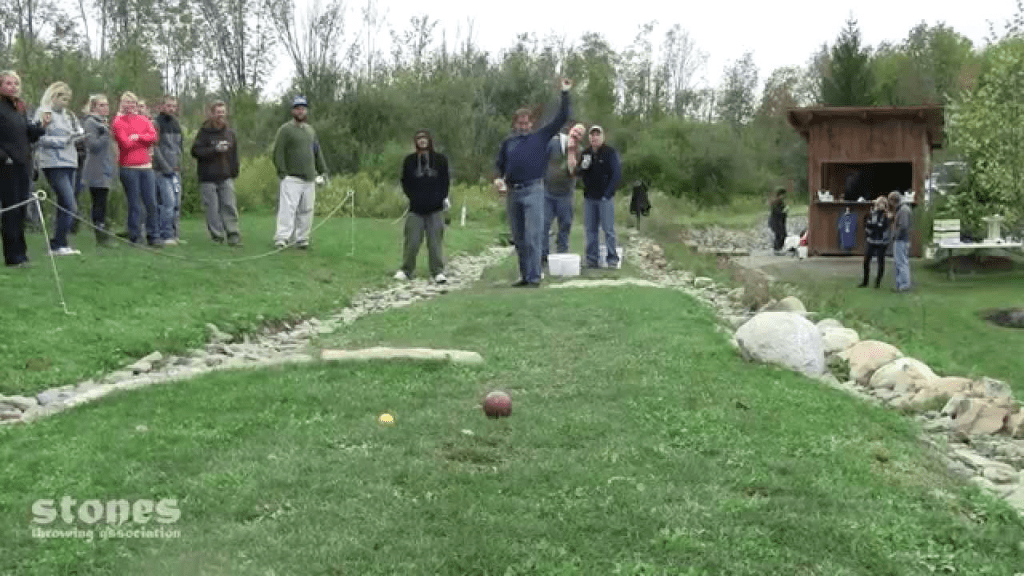
A Stones course is five stretches (holes) that take you through mowed fairways, sand traps, and rough patches, around and through trees and stone fixtures, up and down hills. There are clear boundaries on each stretch (sometimes it’s a pool of water!). You play the five stretches, tossing four stones per round -some stretches remind you of golf par threes, some are longer and remind you of a par five. All stretches score the same, you throw your stones, score the stretch and move onto the next, unique challenge. There are sixteen basic rules of play and etiquette, but like golf (which has only a few rules), it’s the interpretations that are abundant…especially when you take balls of any sort into the wild and toss or hit them around.
There. Simple.
And, in Lakewood, it’s played in a beer garden. What could be better than that?
Kade manages the Southern Tier course called Brewers Hollow. “I manage all events like leagues and tournaments there,” Sivak says. Brewer’s Hollow is the first public stones course ever built, constructed by Sivak Stonemasonry. “They work as a course designer and builder for any new courses at other breweries or businesses that want to enjoy the game of Stones. We encourage people if they ever see a place that could fit a Stones course to check out our website and reach out to us so we can attempt to make that dream come true!”
Brewer’s Hollow is the premier Stones venue in, well, the world. “We’ve hosted hundreds of tournaments as well as leagues every summer and fall that fill up quick, but we are always looking to expand and host more players each night,” Kade says. “We have a world championship every year, with last year’s having a cash prize of $1,000. This year we are attempting to take it to the next level and really give people the best experience at each tournament that is planned out this year.
“STA tournaments and leagues are on the website that vary in competitiveness. As well as a team league called the National Stones League, that includes teams like the Buffalo Mafia, the Jamestown Ironmongers, Chautauqua Armada, and the Pittsburgh Chaos. This team league is peak competition as it is a different approach to the game but takes all the best players and faces them off in 8v8 competition.”
Play at Brewer’s Hollow, like most outdoor sports in the area, follows the weather. Kade continiues, “For casual play we will be opening up May 18th on Southern Tier Public Day where we will be offering each new players first game free as well as have the option to have a skilled player help them learn the game. Then we’re open Wednesday through Sunday until the end of September.
“We’re promoting this year as ‘The Year of Stones’, so if you’ve never played, this would be a good time to come try out the game. It’s easy, fun, and doesn’t take long to play a match. The Stones community is filled with great people that are always willing to help teach new players and it’ll be the best outdoor activity in the area.
Do a quick thought experiment before reading on. Make ice without electricity.
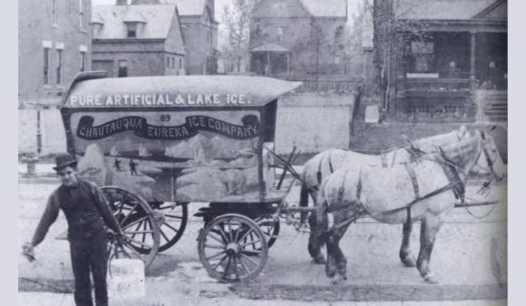
Of all the day-to-day comforts we take for granted, the human ability to create cold might be the most underrated (heat was a piece of cake). Refrigeration, other than via of evaporation and air movement, wasn’t invented until the 1830’s. It wasn’t perfected for another century. There is no reliable data that recorded how many refrigerators were in United States homes prior to 1940, but it wasn’t many (by 1944 they were in about half the households).
If you wanted something cold, it meant ice.
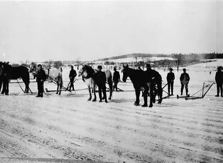
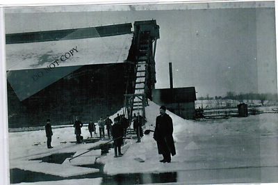
Ice harvest on Chautauqua Lake was a boom business from the 1880’s through the 1910’s; twenty to forty-thousand tons removed from the lake yearly and shipped to ice houses, mostly in Pittsburgh, but west to Cleveland and east to Buffalo as well. Ice was a regional industry that moved tens of thousands of tons of product and employed entire work forces through long winters.
Chautauqua Lake has a low shoreline, easily accessible. The upper basin has a depth best for growing ice. By late January every year crews lay out a cutting schedule, dividing the ice into a grid of blocks twenty-two by thirty-two inches, with a depth of twelve to eighteen inches. Blocks weigh between a hundred-fifty and three-hundred pounds. Giant saws cut up the grids and horse-drawn sleds pull the ice onto shore. Ice is loaded onto wagons and transferred to train stations. The blocks are standardized to maximize storage. A single railcar can carry thirty to forty tons of tightly packed ice, and during the busiest weeks, multiple cars depart daily for industrial centers. Ice from Chautauqua Lake is known throughout the east for its clarity and slow melt rate, qualities that reduce losses during transport and increase its commercial value. A block of Chautauqua ice can last ten to twelve months if stored correctly.
The Celoron Ice Company and facilities in Mayville maintained storage capacity for more than ten-thousand tons, not simply stacks of frozen water, but inventory, revenue, and the wages of hundreds of workers. Families depended on the harvest to bridge the financial gap between fall and spring.
But the industry operated on narrow margins, dependent on the weather. A solid freeze determined whether a year would be profitable. Mild winters, or untimely thaws, could ruin an entire harvest season, which trickled down to all the industry that counted on ice, including service to individual homes. This ice had to last until the next freeze and provide winter wages for ice workers, wages that were comparatively strong for the era—often $1.50 to $2.00 per day when factory work paid closer to $1.00.
Icehouses were feats of practical engineering. The Celoron structure was a massive wooden complex along the shoreline, insulated heavily with sawdust (sawdust was the perfect insulation, a limited conductor of heat, and cheap), it could preserve ice into September. Storage capacity was precise, every cubic foot represented potential income. A fully stocked icehouse could hold a value equivalent to hundreds of thousands of dollars in today’s dollars.
Before rail expansion, natural ice rarely traveled far from its source. Afterward, it became a critical component of food distribution, brewing, and industrial cooling across multiple states. Thousands of tons left the Chautauqua Lake with breweries among the largest consumers.
By the 1920s mechanical refrigeration technology began to offset the ice industry. Prices for natural ice, once $4 to $6 per ton, fell to $1. Profit margins collapsed. Icehouses that had operated for decades closed, buildings were dismantled, equipment was sold for scrap, and workers moved into factories, railroads, and other emerging industries. The transition happened quickly enough that many communities experienced it as a sudden end rather than a gradual decline. Chautauqua County was no exception, but in its halcyon days, frozen water from the lake was a major local business.
The Erasure of The Town of Elko, Cattaraugus County
They stood to the side, each waiting his turn in this muddy, rainy, sad place. They shook their heads absently, involuntarily, in mute objection, careful not to make eye contact with the others loitering at the rusted cast-iron fence encircling the graveyard. They stood in quiet witness as their ancestors were exhumed, loaded onto a truck, and swept from their not-so-final-after-all resting place. There was a hum of sadness, dampened by helplessness, fury, and simple confusion.
Eminent Domain. It’s an unapologetic, legally convenient sledgehammer. It’s a piece of paper that’s handed to you, at your front door, from an official in a sharp suit, white collar, and soft hat. It’s a thief in the night. A cudgel. It’s a bulldozer ripping up your house, your white picket fence, your vegetable garden, and your heart.
It’s what you get when you’re in the way.
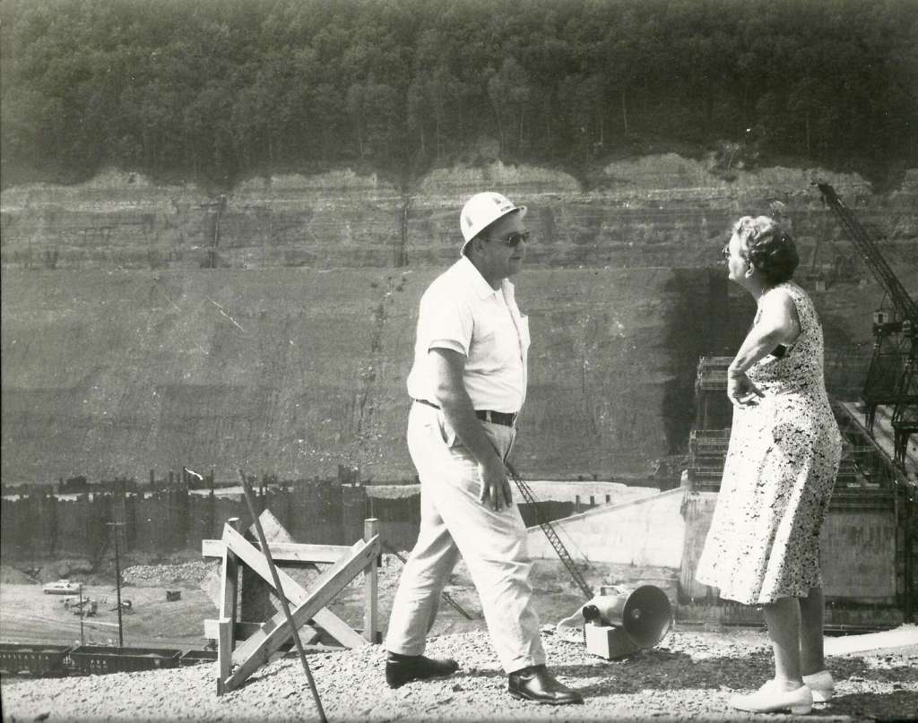
A Citizen of The Allegheny Valley Confronts a Kinzua Dam Project Worker
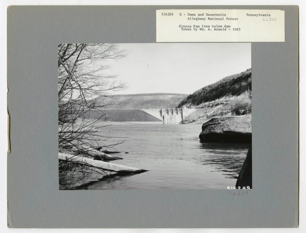
The Allegheny River valley had been inhabited for centuries by the Seneca Indians, then European settlers. It was a rural oasis filled with orchards, hunting grounds, fishing spots, family farms, small towns with hardware stores and churches. Then the Kinzua Dam was built, the water rose, and those places were entombed beneath a lake. The local knowledge disappeared; a populated landscape became a memory.
Before the flooding began, the Army Corps of Engineers conducted surveys to locate every known cemetery and individual grave that would be destroyed when the dam went into operation. They worked with non-native families, churches, and the Seneca Nation to identify descendants and next of kin. Grave markers were cataloged, photographed, and mapped. Headstones were moved when possible; otherwise, new markers were provided.
Licensed funeral directors and contracted crews carried out the mass disinterment. Remains were placed in new caskets or containers to be moved. Personal items buried with individuals were reinterred unless families requested otherwise. Families were given the option to choose a new burial location if they wished.
What else were they supposed to do?
Public memory focuses on the Seneca displacement and their fight with the government for the right to keep their land above water, all the way to the Supreme Court. They appealed directly to President Kennedy.
But a dam doesn’t discriminate. The non-natives, citizens of Elko, Kinzua, and Morrison, had no ground to stand on when the government came calling with their pieces of paper, no one advocated for them, no treaty protected their rights to keep their land, to leave their people buried in the place they wanted. The Kinzua project drowned a valley that had sustained people for generations. It demonstrated how easily federal priorities, in this case Cold War flood control, could override local lives.
Public Outcry over the Controversial Construction of The Kinzua Dam
Elko residents in particular suffered. The town was declared uninhabitable by decree, its government dissolved. Property deeds were voided. Houses were condemned, bought out, or bulldozed. People who had expected to pass their land to their children instead watched surveyors mark it for destruction. Entire neighborhoods were boxed up and scattered across Cattaraugus County and beyond. Even the name Elko was removed from maps, as if it had never existed.
This is not a tale from early American homesteaders. It happened in 1960. It happened in Cattaraugus Conty. It happened to people our parents and grandparents might have known. It happened to roads in Elko that led to and from the post office, the grocery store. To neighborhoods that hosted block parties and garage sales, to church picnics, to BINGO, to the park with its gazebo and summer bands and ice cream. To roads that brought Christmas carolers, where you walked your dog, strolled under streetlamps and caught fireflies.
By 1965 all those roads ended in water.
Forever Ain’t What it Used to Be. George Washington and The Kinzua Dam
The Senecas hold a Day Of Remembrance every year to honor the spirits of those who passed during that time, and to make sure that such a tragedy never happens again.
The non-natives of the Allegheny Valley hold no such ceremony.
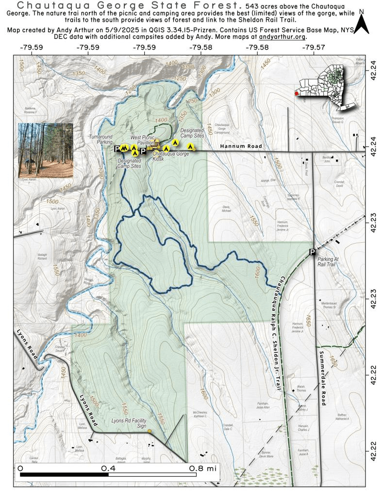
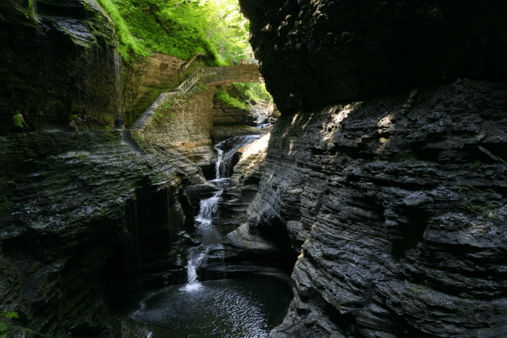
If you live in the west part of the county, you’re undoubtedly familiar with the Chautauqua Gorge. It’s 538 acres of state land, easily accessible from launch points from Mayville to Westfield.
For most of the other points of the compass, that natural geological Western New York wonder contains a bit of a mystery. It’s a striking natural feature that has captured the attention of geologists, hikers, and nature lovers, with its rugged beauty, unique geological features, and tranquil atmosphere.
Chautauqua County has an exposed geological record dating back about 370 million years. Chautauqua Gorge is a product of millions of years of geological activity, most of the architecture coming from the forces of glaciation and erosion, continuously sculpted by the flowing waters of Chautauqua Creek, which isn’t done with the mosaic; that estuary continues to erode the underlying layers of sedimentary rock (shale, sandstone, and limestone). These rock deposits were layered in ancient seas over. You can see the 350-million-year history of the area in exposed rock layers, earth’s geological history mapped before your eyes, millennia of erosion, water flow, and natural weathering. It’s a valuable and unique classroom for geologists, offering insights into the region’s prehistoric past and the forces that shaped the Appalachian Plateau.
That geological history also informs an ecological treasure trove, a feature of the gorge. The gorge and the surrounding watershed support a cornucopia of flora and fauna. The cool, damp environment creates a microclimate that is ideal for several species of plants, including ferns, mosses, and wildflowers. The dense vegetation along the creek provides a rich habitat for wildlife, including deer, foxes, and a variety of bird species, from warblers to raptors (it’s a vital corridor for migratory species, providing shelter and food). The creek itself is home to various aquatic species, including brook trout, which thrive in the cold, clear waters. The biodiversity of the gorge adds to its ecological significance, making it a crucial area for conservation efforts.
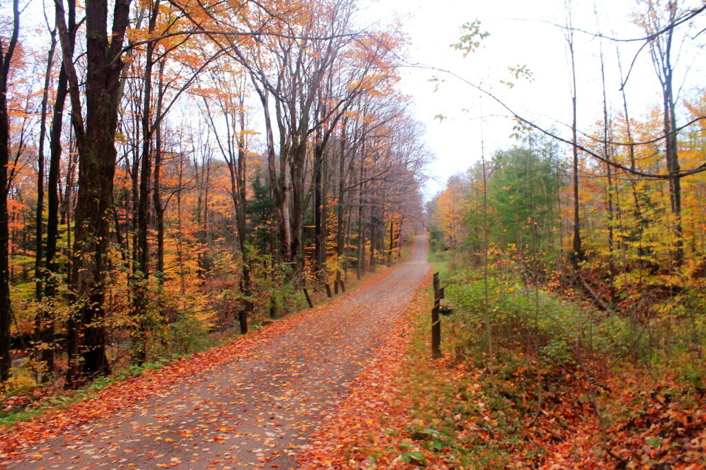
The gorge is an amusement park for outdoor activities. A short trail leads to an impressive swimming hole, complete with waterfalls that cascade crystal clear (chilly!) water into collecting ponds, with fossils embedded in the shale that frame the creek. There are several trails winding through the gorge, offering varying levels of difficulty for both casual hikers and more seasoned adventurers. Trails are regularly maintained to reduce the impact of human activity on the environment. One of the most popular routes is the Chautauqua Gorge Trail, which follows the creek and provides stunning views of the cliffs and waterfalls.
The creek itself is a draw for anglers, especially those interested in fly fishing. The brook trout population makes Chautauqua Creek a prized fishing spot, particularly in the spring and fall when water levels are higher. In addition to fishing and hiking, visitors can enjoy picnicking, birdwatching, and photography. During the winter months, the gorge becomes a peaceful retreat for snowshoeing and cross-country skiing.
In addition to its recreational value, Chautauqua Gorge has significant educational and cultural importance. The area’s rich geological history makes it an excellent outdoor classroom for students and researchers studying earth sciences. Field trips to the gorge offer hands-on learning opportunities about rock formations, erosion, and watershed ecology. Educators from local schools and universities often bring students to the gorge to study its unique features and to observe the interactions between the natural environment and the wildlife that inhabits it.
Local environmental groups, in collaboration with state agencies, have taken steps to protect the gorge and its surrounding watershed. Efforts to maintain the health of the creek and prevent erosion are ongoing, with projects aimed at stabilizing the banks and removing invasive species that threaten native plants and wildlife.
The beauty and ecological significance of Chautauqua Gorge make conservation efforts essential for its preservation. Visitors to the gorge are encouraged to follow “Leave No Trace” principles, ensuring that the area remains pristine for future generations. By fostering a sense of environmental responsibility, conservation organizations hope to preserve the natural beauty of Chautauqua Gorge while allowing people to continue enjoying its many offerings.
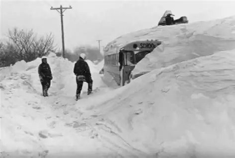
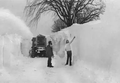
Lake Erie froze solid December 16th, 1976. That’s early. It happens, earlier some years, but the lake almost always thaws after that at some point. We use Lake Erie’s surface status as a snowfall predictor. A solid Lake Erie usually means a milder winter; annual nor-eastern winds skim over the ice instead of pulling moisture and turning it into pregnant snow bands. A liquid Erie generates familiar snow bands and squalls, winters that turn a hundred inches of snow into two hundred.
In 1976 the lake froze and stayed that way, the traditional harbinger of relatively mild snowfall for counties bordering the great lake. The difference in ‘76 was an unusually heavy snowfall over the lake. Precipitation that would normally melt, accumulated on the lake’s surface, deep, wispy, light snow.
January of 1977 was the coldest month on record in Western New York to that date, averaging 13.8 °F. There was no melt, anywhere, and snowfall throughout the month, though not overwhelming, was steady. Bufalo had fifty-nine inches by the middle of January. There is no reported total snowfall for Jamestown, Dunkirk or Olean prior to the storm, but all three cities had over a hundred forty inches after the blizzard hit.
And the snow on Lake Erie was piled high…too high.
Thursday, January 27th. An arctic front builds a wall of snow that passes through Indianapolis, then Columbus, Toledo and Cleveland, Ohio. By evening the wall arrives in Erie, Pennsylvania (Erie will report more than five hundred vehicles accidents that morning). Winds scoop up all that snow off Lake Erie and carry it east with the already-packed clouds. Thursday night winds hit forty-nine miles per hour, driving a once in a century blizzard toward Western, New York.
Friday, January 28th. Witnesses describe what looks like a grey mist moving toward the southeastern cities bordering Lake Erie. Lightning flashes inside the maelstrom.
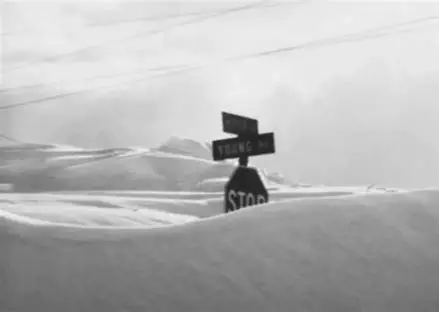
The mist turns into a menacing wall of white as it closes on the southern tier of New York, a blanket is thrown over the world. Visibility is nonexistent inside the white hurricane. The mass of snow from Lake Erie is dropped randomly all over Chautauqua, Cattaraugus, Erie, and Wyoming counties. By 1:00 pm snow begins to cover cars, first bumper high, then up to the windows. By evening drifts fifteen feet high are scattered throughout the region. The wind whips and shapes the snow without discrimination. Mounds of snow are picked up and randomly dropped, then moved again. A road that is bare one minute is impassable the next, shocking travelers with the arbitrary intensity.
Friday evening, winds gust to almost seventy miles per hour. Wind chills drop to sixty degrees below zero.By midnight, Buffalo, New York is crippled, an estimated two thousand cars are stranded on Main Street and about eight thousand on streets throughout the city. The south towns are frozen solid, covered in drifts.
Saturday, January 29th. Visibility improves in the morning, and municipalities send their plows and emergency crews out to clean up and assess damage. Abandoned cars are a major impediment to the effort. In Buffalo, trucks and payloaders dump snow into the Niagara River. In the south towns of Chautauqua and Cattaraugus counties area roads have become wintry tunnels, and parking lots are filled with banks of snow removed from roads.
Sunday, January 30th. The wind and snow subside, and the sun comes out briefly. Towns come alive. Major roads are cleared.
With the weather softening and single lanes on major roads clearing, people head out into the world, to run errands, to witness the marvels of the blizzard.
But the wind isn’t done with New York. At 3:00 pm, the wind increases and blowing snow once again turns visibility to nil. Driving becomes treacherous. Vehicles are stranded anew and abandoned cars block roads that had just been freed. A peak gust of 58 mph is recorded at the Buffalo airport. That night the wind chill falls to minus forty degrees.
Monday, January 31st. Most roads are closed by overnight snow. Fire departments spend time checking houses snow-covered to their roofs to make sure nobody is freezing or suffocating.
The blizzard has blown itself out. The effects of its carnage are just being realized.
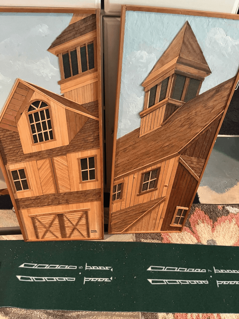
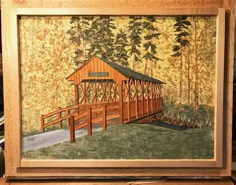
He looked at the natural world differently than me and you, most probably, with an artist’s eye. You could tell then -if you saw him cruising the lake shoreline attuned to driftwood, touching trees for texture, skimming wood scraps of fallen lumber for the right shape, the perfect color or grain- that he sought something we didn’t see.
You can tell now by the collection of bark, pebbles, and myriad species of flora stored at the house of his protégé, Greg Wefing.
Cecil Rhodes has been gone for some eleven years now, passed away in 2013. He was a schoolteacher at Maple Grove High School, classically trained in industrial design at the Pratt Institute of Brooklyn, and at teaching at Edinboro University of Pennsylvania. He was also a local legend and celebrated creator of what he called then, and Greg calls now, Woodscape art.
Woodscapes are crafted with different sizes and various species of wood sometimes enhanced with colored stains and paints. They are like three-dimensional paintings. Greg has a collection of his own work, and a few of Cecil’s pieces as well. A Woodscape of Wefing’s has hung the Bemus Village Hall for about thirty years.
Rhodes essentially invented the discipline of Woodscapes in the late 1970’s and early 80’s. He’d been employed in the garment district of New York City for eleven years, a teacher for five more at Maple Grove (his de facto alma mater, graduating from Bemus Point High School in 1950), and a boat repair specialist when he realized he had an aptitude for art, and that wood was his medium.
“Cecil created from his imagination, I think. He’d get an idea and be able to make a piece. I do mine from pictures I find, usually in calendars and magazines.” Wefing is standing in front of a pile of nature-art planners and mags on a workbench in his basement workshop. Lining the wall are shelves of wood strips and filings of various color and texture. “Something will kind of jump out at me, and I’ll have a new project.”
And then he goes to work, unearthing the raw material that will form his art. Greg is now the person you’ll find in the Bemus area combing the natural world for the right materials to fulfill a vision and build Woodscape art. “Yeah, I’m the guy you see cutting down tall grass or cattails on the side of the road. Or at the lake looking for driftwood, peeling bark off a tree,” he says.
The village of Bemus Point, when you drill down to the locals (that population that spends years in the same place, completing their routines, season after season) is character driven. Cecil Rhodes was semi-famous for his meticulous, detail-driven artwork. Wefing has followed a similar path, building a trove of bas relief art that’s impressive for its detailed craftsmanship and vision. “I worked for Cecil for two or three years while I went to art school,” he says. “Cecil worked mostly with wood tones. I started to add some color to mine. They’re a little different, but a lot of the same techniques, the same process.”
Wefing figures he could knock off a piece in a week if he put in the hours. But he does his art at his own pace. “I usually do about five a winter, down here in the studio, when the weather is bad. I’ve done commissioned work, but don’t really like it. I like to work at my own pace, on my own projects.” He says Cecil’s efforts to mainstream the art wasn’t as successful as his individual creations. “He was thinking we might mass produce some of his pieces, and I was going to be part of that. It never really worked out. His art was pretty special.”
Wefing isn’t really in it for the money (though he could be, his work is that good), but does sell his art, informally, and mostly from his Facebook home page.
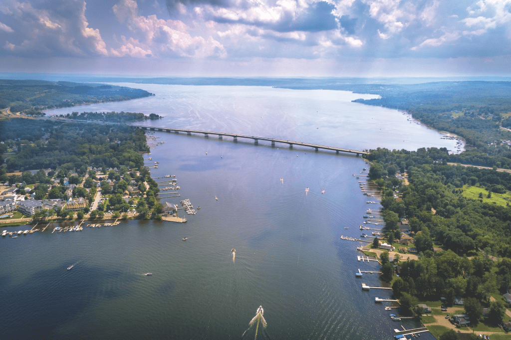
In October of 1982, 726 athletes lined up in Bemus Point with the goal of crossing the lake and back. The lake was much too cold for a swim. The Bemus Pint Ferry was not an option for a Fall 10K race. Fortunately, these runners had a fresh path, brand spanking new pavement, the Chautauqua County Veterans Memorial Bridge.
There was a time when getting from the southern part of Chautauqua Lake to the upper lake was a logistical chore, Mayville to Jamestown was a journey, more than a grocery run. Routes 394 and 430 wrapped the lake, picturesque to be sure, but cumbersome for anyone in a hurry. This was prior to 1982. A drive from Jamestown to Long Point State Park was a common trip, fifteen miles or so up the north side of the lake.
If you then wanted to tour the southwestern coast, Stowe, Chautauqua Institution, or points south, you had one of three options:
Circumnavigate the lake, back through Jamestown, or north around Mayville.
Drive into Bemus, hope to catch the ferry.
The ferry had to be running that day.
The ferry had to be on your side, ready to go to the other side.
You had to be the one of the first ten or so cars in line.
For an intrastate trip through New York, from the west to east you used the I-90 corridor along Lake Erie, all southern cities, Jamestown, Olean, Corning, and east, were accessible by backroads only. What is now Route I86 as a developed interstate highway wasn’t a priority because of that pesky lake blocking any straight run west to east.
That changed in 1982 with the building of the Chautauqua County Veterans Memorial Bridge.
That Fall 10K race in Bemus, launching the opening of the first non-stop vehicle option for getting from one side of the lake to the other, was forty-two years ago, a long time for a bridge. Now it’s in need of a facelift. Or in lieu of a cosmetic revival, some body work.
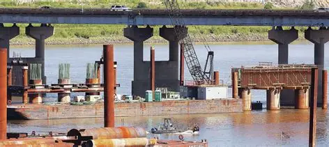
Enter New York State Department of Transportation and their checkbook.
The state has earmarked $78 million for renovations and structural work on the Chautauqua County Veteran’s Bridge. Another $4.7 million for the local success routes to the bridge off routes 430 and 394. Work began on the main part of the 3,790-foot main span last summer (2023). It’s expected to be completed fall of 2026.
New York State DOT Commissioner Marie Therese-Dominguez was in Chautauqua recently to oversee the start of the project. “It’s going to enhance safety, it’s going to ease travel and it going to extend the service life of these bridges by another 40 years,” she said.
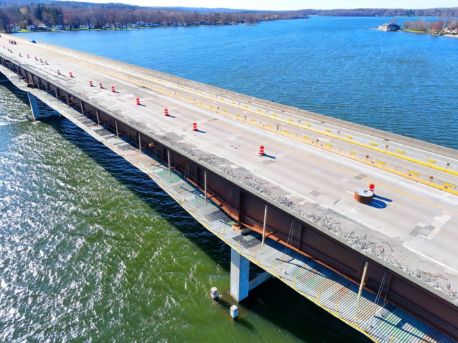
The work being done probably won’t show itself to the casual observer -new bridge joints, fresh decks, bearings, and repaired steel. The roadway will be resurfaced. On and off ramps will have new barriers.
The noticeable part will be the closures and re-routing of traffic to get the job completed. The plan is to work one set of lanes at a time, and only close the entire bridge for short periods during nighttime. Local officials are of course asking people to be patient with the process and disruptions in traffic.
Commissioner Therese-Dominguez says, “It’s going to take a lot of patience but in the end, I think it’s going to be well worth it.”
Governor Hochul released a statement saying, “To ensure that our communities and our economy in all regions of the state continue to grow and prosper, New York state is making investments to strengthen and harden our infrastructure to meet and exceed the challenges of the 21st Century.”
State Sen. George Borrello, R-Irving, thanked Hochul for recognizing the importance of the bridge and the need to bolster the structure. “She is no stranger to Chautauqua County, no stranger to Chautauqua Lake and she knows the importance of it,” he said. “I want to truly thank her for investing in infrastructure around Chautauqua County, particular, this major, major investment in this bridge over Chautauqua Lake.”