ELKO AND THE KINZUA DAM PROJECT

 PART II

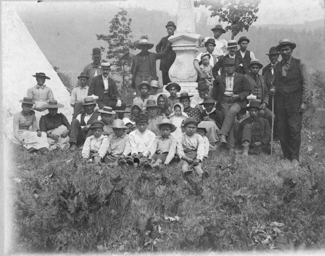
The Erasure of The Town of Elko, Cattaraugus County

They stood to the side, each waiting his turn in this muddy, rainy, sad place. They shook their heads absently, involuntarily, in mute objection, careful not to make eye contact with the others loitering at the rusted cast-iron fence encircling the graveyard. They stood in quiet witness as their ancestors were exhumed, loaded onto a truck, and swept from their not-so-final-after-all resting place. There was a hum of sadness, dampened by helplessness, fury, and simple confusion.

Eminent Domain. It’s an unapologetic, legally convenient sledgehammer. It’s a piece of paper that’s handed to you, at your front door, from an official in a sharp suit, white collar, and soft hat. It’s a thief in the night. A cudgel. It’s a bulldozer ripping up your house, your white picket fence, your vegetable garden, and your heart.

It’s what you get when you’re in the way.

A Citizen of The Allegheny Valley Confronts a Kinzua Dam Project Worker

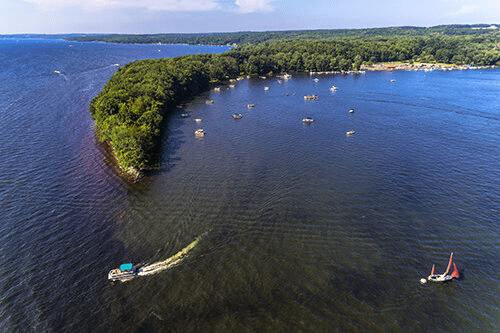
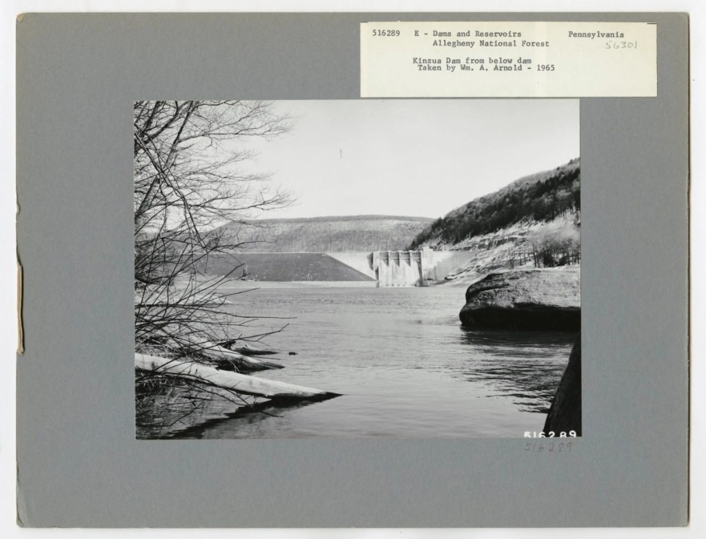
The Allegheny River valley had been inhabited for centuries by the Seneca Indians, then European settlers. It was a rural oasis filled with orchards, hunting grounds, fishing spots, family farms, small towns with hardware stores and churches. Then the Kinzua Dam was built, the water rose, and those places were entombed beneath a lake. The local knowledge disappeared; a populated landscape became a memory.

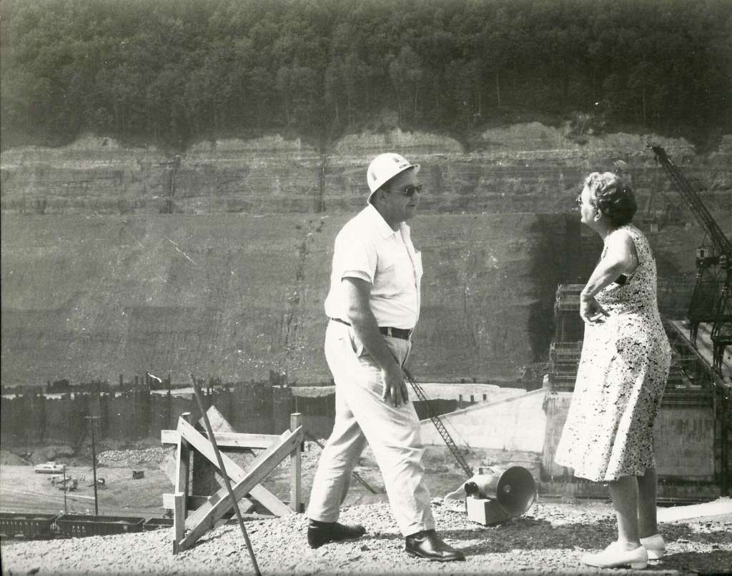
      Before the flooding began, the Army Corps of Engineers conducted surveys to locate every known cemetery and individual grave that would be destroyed when the dam went into operation. They worked with non-native families, churches, and the Seneca Nation to identify descendants and next of kin. Grave markers were cataloged, photographed, and mapped. Headstones were moved when possible; otherwise, new markers were provided.

Licensed funeral directors and contracted crews carried out the mass disinterment. Remains were placed in new caskets or containers to be moved. Personal items buried with individuals were reinterred unless families requested otherwise. Families were given the option to choose a new burial location if they wished.

     What else were they supposed to do?

Public memory focuses on the Seneca displacement and their fight with the government for the right to keep their land above water, all the way to the Supreme Court. They appealed directly to President Kennedy.

     But a dam doesn’t discriminate. The non-natives, citizens of Elko, Kinzua, and Morrison, had no ground to stand on when the government came calling with their pieces of paper, no one advocated for them, no treaty protected their rights to keep their land, to leave their people buried in the place they wanted. The Kinzua project drowned a valley that had sustained people for generations. It demonstrated how easily federal priorities, in this case Cold War flood control, could override local lives.

Public Outcry over the Controversial Construction of The Kinzua Dam

     Elko residents in particular suffered. The town was declared uninhabitable by decree, its government dissolved. Property deeds were voided. Houses were condemned, bought out, or bulldozed. People who had expected to pass their land to their children instead watched surveyors mark it for destruction. Entire neighborhoods were boxed up and scattered across Cattaraugus County and beyond. Even the name Elko was removed from maps, as if it had never existed.

This is not a tale from early American homesteaders. It happened in 1960. It happened in Cattaraugus Conty. It happened to people our parents and grandparents might have known. It happened to roads in Elko that led to and from the post office, the grocery store. To neighborhoods that hosted block parties and garage sales, to church picnics, to BINGO, to the park with its gazebo and summer bands and ice cream. To roads that brought Christmas carolers, where you walked your dog, strolled under streetlamps and caught fireflies.

By 1965 all those roads ended in water.

Forever Ain’t What it Used to Be. George Washington and The Kinzua Dam

The Senecas hold a Day Of Remembrance every year to honor the spirits of those who passed during that time, and to make sure that such a tragedy never happens again.

     The non-natives of the Allegheny Valley hold no such ceremony.

The Chautauqua Gorge

If you live in the west part of the county, you’re undoubtedly familiar with the Chautauqua Gorge. It’s 538 acres of state land, easily accessible from launch points from Mayville to Westfield.

For most of the other points of the compass, that natural geological Western New York wonder contains a bit of a mystery. It’s a striking natural feature that has captured the attention of geologists, hikers, and nature lovers, with its rugged beauty, unique geological features, and tranquil atmosphere.

Chautauqua County has an exposed geological record dating back about 370 million years. Chautauqua Gorge is a product of millions of years of geological activity, most of the architecture coming from the forces of glaciation and erosion, continuously sculpted by the flowing waters of Chautauqua Creek, which isn’t done with the mosaic; that estuary continues to erode the underlying layers of sedimentary rock (shale, sandstone, and limestone). These rock deposits were layered in ancient seas over. You can see the 350-million-year history of the area in exposed rock layers, earth’s geological history mapped before your eyes, millennia of erosion, water flow, and natural weathering. It’s a valuable and unique classroom for geologists, offering insights into the region’s prehistoric past and the forces that shaped the Appalachian Plateau.

That geological history also informs an ecological treasure trove, a feature of the gorge. The gorge and the surrounding watershed support a cornucopia of flora and fauna. The cool, damp environment creates a microclimate that is ideal for several species of plants, including ferns, mosses, and wildflowers. The dense vegetation along the creek provides a rich habitat for wildlife, including deer, foxes, and a variety of bird species, from warblers to raptors (it’s a vital corridor for migratory species, providing shelter and food). The creek itself is home to various aquatic species, including brook trout, which thrive in the cold, clear waters. The biodiversity of the gorge adds to its ecological significance, making it a crucial area for conservation efforts.

The gorge is an amusement park for outdoor activities. A short trail leads to an impressive swimming hole, complete with waterfalls that cascade crystal clear (chilly!) water into collecting ponds, with fossils embedded in the shale that frame the creek. There are several trails winding through the gorge, offering varying levels of difficulty for both casual hikers and more seasoned adventurers. Trails are regularly maintained to reduce the impact of human activity on the environment. One of the most popular routes is the Chautauqua Gorge Trail, which follows the creek and provides stunning views of the cliffs and waterfalls.

The creek itself is a draw for anglers, especially those interested in fly fishing. The brook trout population makes Chautauqua Creek a prized fishing spot, particularly in the spring and fall when water levels are higher. In addition to fishing and hiking, visitors can enjoy picnicking, birdwatching, and photography. During the winter months, the gorge becomes a peaceful retreat for snowshoeing and cross-country skiing.

In addition to its recreational value, Chautauqua Gorge has significant educational and cultural importance. The area’s rich geological history makes it an excellent outdoor classroom for students and researchers studying earth sciences. Field trips to the gorge offer hands-on learning opportunities about rock formations, erosion, and watershed ecology. Educators from local schools and universities often bring students to the gorge to study its unique features and to observe the interactions between the natural environment and the wildlife that inhabits it.

Local environmental groups, in collaboration with state agencies, have taken steps to protect the gorge and its surrounding watershed. Efforts to maintain the health of the creek and prevent erosion are ongoing, with projects aimed at stabilizing the banks and removing invasive species that threaten native plants and wildlife.

     The beauty and ecological significance of Chautauqua Gorge make conservation efforts essential for its preservation. Visitors to the gorge are encouraged to follow “Leave No Trace” principles, ensuring that the area remains pristine for future generations. By fostering a sense of environmental responsibility, conservation organizations hope to preserve the natural beauty of Chautauqua Gorge while allowing people to continue enjoying its many offerings.

A Really Good (not Great) Lake

In the northern part of Chautauqua County, between the lake there and the Great Lake Erie, there’s a place where the earth curves. Actually, there’s many such hills, but this one’s special.

The Chautauqua Ridge is a demarcation of confluence. It plays a small part in splitting the continent in half, between north and south. It’s a rare geological marvel, and it’s right here, where we live. The old saw goes that if there was a building built in the middle of the ridge, that rain falling on the north side would end up in the Atlantic Ocean (Lake Erie to the Saint Lawrence Seaway), and a rain falling on the south side would eventually be deposited in the Gulf of Mexico (Chadakoin to Conewango Creek, Allegheny, Ohio and Mississippi Rivers, past New Orleans into the gulf).

Along that southern route is Lake Chautauqua.

Chautauqua is fed by a dozen or so arterial creeks (Ball, Bemus, Big Inlet, Dewittville, Dutch Hollow, Goose, Lighthouse, Little Inlet, Maple Springs, Mud and Prendergast). At its widest Chautauqua is about two miles. It has a northern and southern basin that squeeze together roughly in the middle. The narrows at Stow and Bemus Point is where the lake is most bridgeable, crossed now New York Interstate 86, and by the Bemus Point ferry on the water. The lake is 17-miles long, a straight-line run from Mayville to Celoron. About forty-one miles is lakefront property, all but about three miles of that privately owned.

     Most people who live on the lake have an attitude of stewardship toward this valuable local resource. It is a prized geological, glacial-built wonder. It is a beacon, and a challenge. The beacon part is obvious, a recreation designation for boaters, fishermen and fisherwomen, and all the entertainment that goes with an easily navigable, accessible body of water.

The challenge? Well, that’s a little more complicated.

The reliance on a lake for the overall financial health of a population can be tenuous. Currently Chautauqua Lake provides the money, the resources, the sustenance of life for much of the south-county population (intermixed with agriculture and manufacturing to be sure). According to the Chautauqua County Office for Media Information, sixty-six percent of visitors to the county use the lake, raising just over $282 million a year. Lakeside municipalities reinvest about $3.2 million back into the lake. The rest of the revenue helps keep businesses open and food on tables via hospitality commerce, and taxes (about 47% of county sales tax is generated annually by lake-border municipalities).

The natural evolution of lakes, what becomes of them in geological timeframes, is that they become forests. Just as water seeks its level, so does the earth. It’s a function of gravity pulling everything down to the lowest points available. Lakes fill in, that’s their natural lifecycle. Runoff from watersheds brings silt and seeds and debris. It settles into the deeper parts of any body of water. Human beings have always been hard on lakes. They invariable get used by populations as depositories for waste. Developing land around lakes, usually the most attractive property, strips a lake of its watershed vegetation and replaces it with construction and chemical residuals. Man-made chemicals cultivate lake weeds that are usually harmful to lake-life.

But as much as man can contribute to the decline of a lake, so can we delay that process, and Chautauqua has champions, people who care for it. Randy Holcomb has been professionally involved with the area around the lake for 47 years (38 in the town assessor’s office and the past nine on the Lakewood Village board). Safe to say he has a feel for the health of the lake, and he is confident in the future of the lower basin as an entertainment and recreation resource. “We welcome the challenge of maintaining lake as a great place to live and visit, Lakewood and Celoron in particular.” His enthusiasm for the future of the lower basin is infectious. “Last year was one of the best we’ve had on the lake in a few years. We’re looking forward to another great summer.”

Chautauqua Lake isn’t in jeopardy of filling in any time soon.