He moved his family to the town of Pomfret in Chautauqua County where he was eventually excommunication from The Fredonia Presbyterian Church for intemperance and misconduct, behavior considered “un‑Christian”.
Asa French Moved His Family to Chautauqua
. . . . .
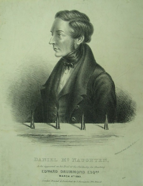
In January 1843, in London, England, a Scottish woodturner named Daniel M’Naghten shot and killed Edward Drummond, the private secretary to Prime Minister Sir Robert Peel. M’Naghten shot Drummond in the back, believing that he was the Prime Minister, serendipitous case of mistaken identity. In his defense a British barrister used a creative, developing legal argument called “the insanity defense” articulated as; “To not know the nature and quality of the act”, or “To know the act, but not know that it was wrong”, summarized as a legal precedent as “the right and wrong test”.
The M’Naghten Rule
Counsel argued that he was innocent of killing Drummond because he was actually trying to kill Peel, which, even for a precedent-setting case, was stretching the limits of the standards of the rule that would be named for M’Naghten (he certainly seemed to know the nature and quality of killing Peel, he just didn’t know precisely what his intended victim looked like).
. . . . .
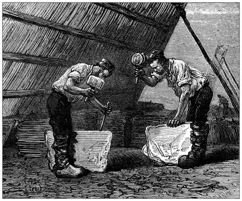
Joseph Damon was a stonecutter in rural Pomfret, Chautauqua County. The Damons were known locally as rough men who worked a quarry near the family home. Joseph was a heavy drinker who complained of frequent migraines, a condition for which a local physician prescribed an unusual remedy: Damon was told to carry port wine with him at all times and drink it as needed. Neighbors remarked that he drank constantly yet rarely appeared drunk.
The Damons Were Stonecutters
In 1834 he lost his mind, at least temporarily, and murdered his wife Almira with an iron fire poker. When discovered, Damon was bloodstained and dazed. He’d called out to his brother, “For God’s sake, come in, I am afraid I have killed my wife”
. . . . .
George French, son of Asa, became one of northern Chautauqua County’s most promising legal minds, despite the instability in his family due to his father’s affliction. George built a reputation for discipline, and civic engagement. By the early 1830s he was practicing law in Fredonia, where he became known for a willingness to take on difficult or precedent‑setting cases.
In 1834, he served as defense counsel for Joseph Damon in what became Chautauqua County’s first recorded insanity plea (nearly nine years before the M’Naghten case that codified the “right and wrong test” into precedent-setting common law). French’s legal strategy was surely informed by his experiences with his father’s behavior, the same actions that got Asa excommunicated from the church. French’s arguments in defense of Damon were eloquent, and sophisticated, drawing on Damon’s long medical history and the questionable treatments he had endured. French bridged law and medical testimony, unusual for rural practices. He became known locally as an attorney willing to push the boundaries of legal reasoning in a rural court system.
. . . . .
Five months after the death of his wife, Damon was brought before the Court of Oyer and Terminer – the high criminal court of the era and a direct predecessor to the modern New York State Supreme Court.
The Court of Oyer and Terminer, Fredonia, New York
But, without the “right and wrong test” standard from the M’Naghten Rule as a precedent, the jury returned a verdict of guilty, and the court ordered that Damon be “hung by the neck until he is dead”.
Land that changes hand in quiet offices, papers filed and stowed with no public fanfare. Check.
A culture that values privacy over commerce, tradition over publicity. Check check.
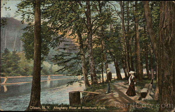
Allegheny River at Riverhurst Park Olean, NY
The Olean–Bayonne Pipeline was built by Standard Oil in the late 1800’s, America’s first long distance pipeline. It ran from Olean, New York, to Bayonne, New Jersey, through the middle of something called the Olean oil‑lease region. It had eleven pump stations approximately twenty-eight miles apart. It moved 50,000 barrels of oil a day.
It was abandoned in 1925, and that pipeline corridor left enough infrastructure to build a small city; construction camps, maintenance shacks and equipment, bunkhouses not on any official maps, known only through oral history and lore. These sites became known as the “lost camps”.
The Doctor’s Camp. A group of Olean-area physicians supposedly bought a secluded piece of land near the Allegheny and built a lodge that doubled as a retreat and a hunting base. The access road was gated, guests were vetted. No signage, no public listing. No patients, no families except on designated weekends, no uninvited guests, no business talk, no emergencies unless someone was actually dying. Fishing, bird hunting, poker, bourbon, and decompressing after 80‑hour weeks.
It was a private escape for professional men who wanted a place where no one could page them, call them, or ask them for a favor. The exact spot varies depending on who tells the story.
The Five Mile/Rock City/Windfall Camps. These camps flourished from the 1930s through the 1970s, tucked into the hills between Five Mile Road, Rock City Road, and Windfall. Several camps were owned jointly by small groups of Olean businessmen. No fighting, no politics, no bragging, no freeloaders, no showing up drunk, no bringing someone who would embarrass the group. Membership was capped, and vacancies only opened when someone died. New members were voted in, and blackballing was common. Outsiders could drive past the access roads for decades and never see a soul.
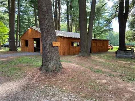
Secluded Camp Site in Olean, NY
The Hinsdale Ridge Catholic Camp. A group of Catholic families from Olean and Allegany supposedly maintained a ridge‑top camp that operated almost like a parish in the woods. Mass was reportedly said there once a year by a priest who was a member.
The Old Reservation Line Camp. This is the most mysterious of the bunch. It wasn’t owned by one group. It was used by Seneca hunters, white lease‑road workers, loggers, and sometimes mixed groups who respected each other’s presence. Don’t bring trouble, don’t disrespect the land, don’t cross the line without knowing whose land you’re on, don’t leave trash, don’t talk too loud about what you saw there. No one ever gave directions; you had to be taken there. It was said to be “neutral ground” where old friendships mattered more than land ownership.
The Lost Pipeline Camps. These camps were most likely forgotten Standard Oil construction camps, or pump‑station satellite camps, and the oldest of the rumored sites. Pipeline construction crews, maintenance men, and lease‑road workers built temporary shacks along the right‑of‑way, structures meant to last a season but were often used for years, rough‑cut buildings of tar paper and lumber, perched near the oil leases and close enough to the pipeline corridor that workers could reach it on foot, an accidental monument to the industrial age that had passed through the foothills. No road signs, no mailbox, no power, only reachable by a rutted track that looked like nothing. Hunters swore they saw lantern lights there in the 1960s, long after the original workers were gone.
Some locals believed the camp was still used once a year for a reunion, but no one could ever prove it.
These weren’t “secret societies, but they were closed circles — groups of men who built something together and kept it within the family. The Allegany foothills are perfect for this kind of lore. It’s the kind of mystery that isn’t solved — it’s inherited.
The Urban Legend is simple, and almost absurd. A man decides to build himself an island. He hauls rocks and fill onto frozen lake during the winter freeze (maybe more than one winter), dumping load after load onto the ice. When spring comes, the ice melts, the rocks sink, and the debris settles into a mound tall enough to crest the waterline. A private perch. A fishing platform. A tiny kingdom.
A Rock Island.
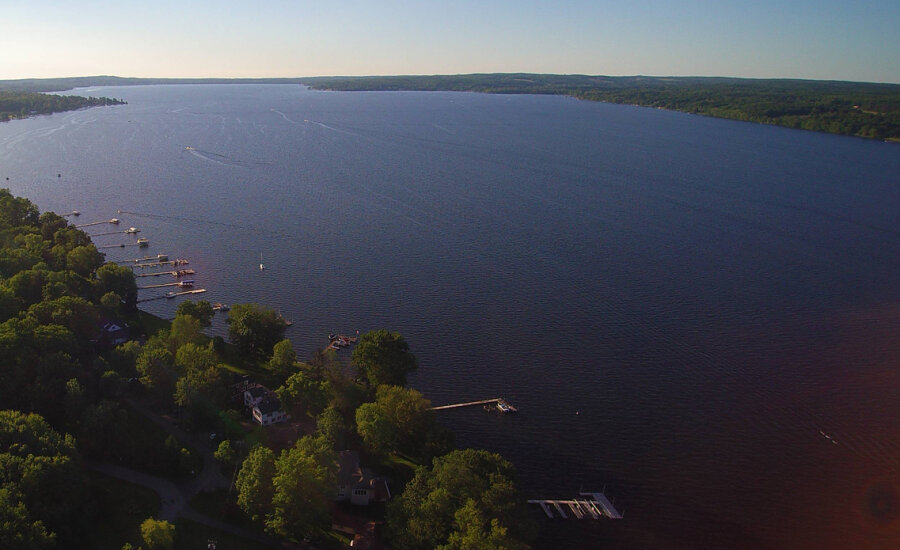
There are things buried in Chautauqua Lake, plenty of things. For instance, the Jamestown Water Works crib was built in 1885, a covered structure to supply Jamestown’s early municipal water system. It was 30 feet square, a tiny artificial island, timber‑framed, stone‑packed, and anchored offshore. It housed the intake pipe that fed the city’s pumps.
There are old steamboat moorings closer to shore; timber and stone structures used to anchor docks. Old ice-harvest platforms are out there; structures built on the ice that sometimes were left too long after the thaw, collapsed and left debris. Private duck blinds are buried in the shallows, built on pilings or rubble.
Docks and Wood Moorings in Chautauqua Lake
And there’s a Rock Island, an expanse of landfill spread over a few hundred square yards buried in the lower part of Chautauqua Lake that rises abruptly from the basin floor, where the water widens into a shallow, silty bowl. The United States Coast Guard Light List and Notices to Mariners does not map a named structure there, but they do show that the area is bordered by special‑purpose hazard markers. Sonar shows a steep‑sided mound with a flat top. That shape is the giveaway. It is not a natural shoal; the lower lake basin is too uniform, too silty, too geologically uneventful. It is not a collapsed crib; those leave rectangular footprints and predictable debris fields. It is not dredge spoil; dredging produces broad fans that spread with the current. It’s too far from shore to be a duck blind, or fishing perch. And it is not a remnant of the Jamestown Water Works crib, that structure sat further down-lake and was meticulously documented.
It is exactly the kind of footprint a failed island‑builder would leave behind.
The Southern Basin of Chautauqua Lake
Boaters call it Rock Island, though no island ever broke the surface. It’s a relatively inexplicable phenomenon, a deliberate pile of stone, placed where no official record says stone should be.
The idea of an “Island Builder” is one of those half‑remembered Chautauqua Lake legends. Searches turn up no formal record, newspaper article, or historical entry about anyone successfully (or unsuccessfully) building an island on Chautauqua Lake. No Chautauqua County Historical Society archives mention a man attempting to build a rock island. No Post‑Journal or WKBW coverage (which would absolutely have covered a stunt like that) contains anything about a rock island project. No state, Corps of Engineers, or environmental reports mention any artificial island attempt on the lake, even a small, unauthorized fill would trigger regulatory attention.
The legend doesn’t include a timestamp, but it’s known that in the 1950’s through the 1980’s shoreline owners routinely dumped fieldstone, broken concrete, and construction debris into the shallows to extend their yards or build makeshift fishing perches. These projects were almost always unpermitted, short‑lived, and inevitably destroyed by ice; anything not heavily anchored with engineering rigor is crushed, shifted, or busted up and sent into the Chadakoin canal. Chautauqua Lake’s freeze–thaw cycles would have destroyed a small rock pile in one winter.
Buoys in the Lower Basin of Chautauqua Lake
The legend persists, not because it is proven, but because the lake itself seems to confirm it. The buoys float above a mystery that behaves exactly like the legend says it should. The hazard is real (as more than a few ruined propellers can attest). The mound is real. The absence of records is real.
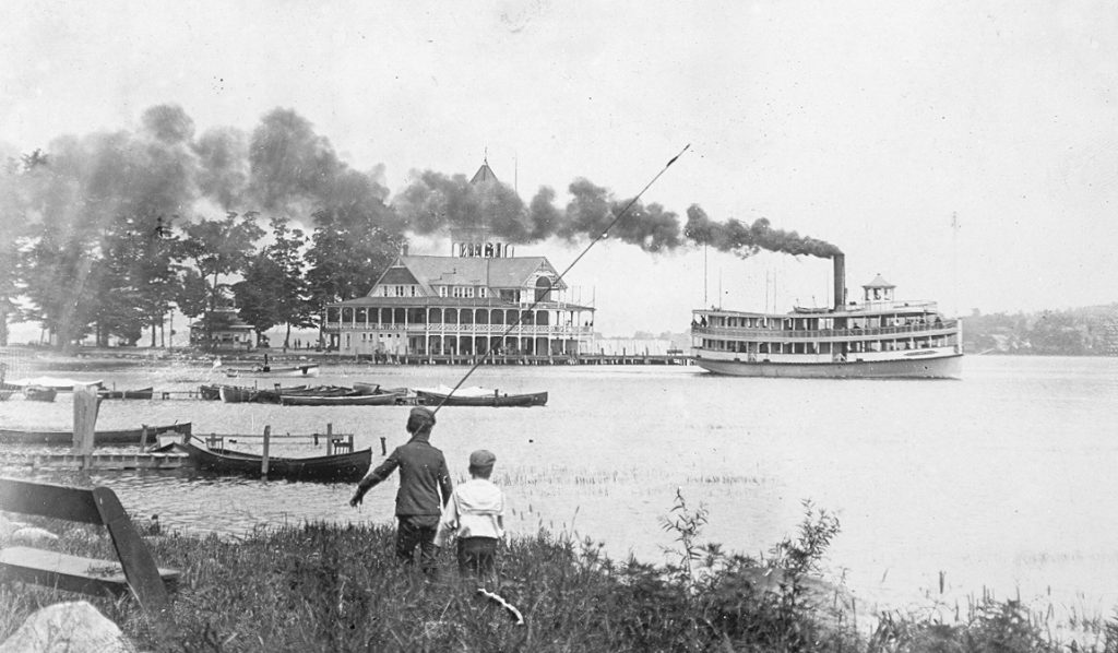
When she blows it is a geyser of wood, iron, and human flesh spouting from the lake, reaching into the August sky, a China Syndrome meltdown of boiling water and steam that kills between five and eight people (steamboats are like busses, you pay your fare as you board) and ruins many more.
Steamboat service on Chautauqua Lake began as early as 1828. By the 1870s, it had grown into a regular, reliable system of travel, a transportation corridor before it was a recreation and entertainment resource; that designation began in the 1890’s when Celoron became “the Coney Island of Chautauqua”.
The lake WAS the highway in 1871. Roads from Jamestown to Bemus or Stow, on to Mayville, were rutted dirt horse-paths. If you wanted to move any significant quantity of livestock, mail, food, timber, or people, you did it on boats like the City of Buffalo, City of Chicago, City of New York, and City of Erie. Competition was fierce, and companies often upgraded engines, cabins, and décor to attract passengers. Consistency, timely delivery of patrons, keeping to a schedule was important to the lines.
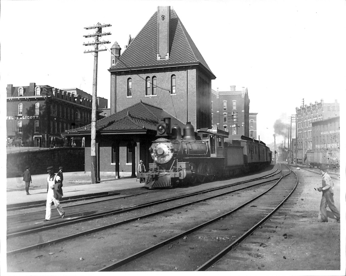
A man steps out of an Atlantic & Great Western Railroad passenger car at the station in Falconer, New York. In 1871, travelers going from Buffalo to Jamestown, ride the “A&GW” on a broad-gauge six-foot line, the only through service connecting Buffalo to the southwest most corner of New York (Buffalo to Hamburg to Gowanda to Dayton to Conewango to Kennedy, to Falconer).
Service on the Buffalo & Jamestown Railroad won’t reach into Jamestown until 1875. Freight interchange that far is limited because of the gauge mismatch, lines going into Jamestown are smaller at 4 foot 8 1/2 inches.
The first direct standard‑gauge rail line into Jamestown
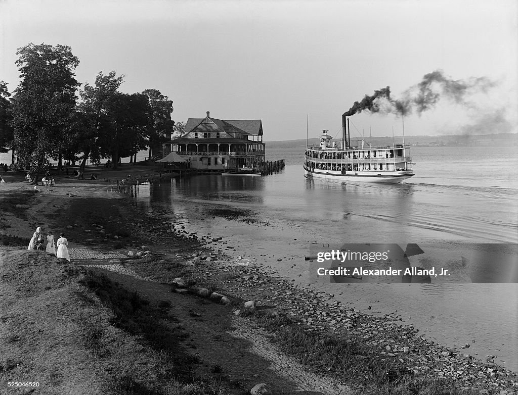
The man hails a carriage to Burtis Bay, named for settler Joseph Burtis -later the area is called Prendergast Point, eventually named Celoron when the city is incorporated in 1896.
The Docks at Celoron, New York
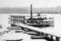
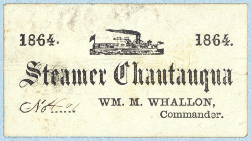
Despite temperatures near ninety degrees, he wears the dark frock coat and light patterned waistcoat of a traveling gentleman, checked trousers with suspenders. He tips his bowler cap to the ladies, checks his pocket watch and hurries to the docks. There he pays his thirty-five cents (an extra five cents for his traveling trunk) and boards the Steamer Chautauqua for a refreshing ride to the upper basin of the lake where he has a farming interest.
The sixteen-foot paddles of the side-wheeler steamer (twelve, five-foot tall buckets built into each) engage and the Chautauqua lurches forward, churning up soot and weeds from the shallow Chadakoin inlet.
A sixteen‑foot wheel on a 120‑foot boat is proportionally large, nearly 14% of the vessel’s total length. That size gives the Chautauqua strong thrust to handle the lake’s shallow, weedy conditions, and good maneuverability for short hops between landings.
It also puts a considerable burden on the boiler that powers the boat.
A young man climbs to the main deck to get some air. He’s just finished feeding the boiler, third load of wood in the last half-hour on orders from the captain. This captain likes speed, likes being ahead of schedule.
It’s too much wood in the young man’s opinion, runs the boiler too hot, but he isn’t about to contradict the captain, this only his second week on the job as boilerman on The Steamer Chautauqua.
The Chautauqua was retrofitted the beginning of summer, 1871, when the Chautauqua Paddle Wheel Company took ownership of her. New paint, new benches for passengers, a new hurricane deck, and a new boiler. New boilers need to be broken in, tested against the haul of the paddle in different conditions, heat levels meticulously maintained and monitored to see how the steamboat reacts and responds. The new boiler on The Chautauqua is no exception.
Except with the summer season here there’s money to be made, people need transportation up and down Chautauqua Lake. They can’t wait -won’t wait- for a boiler to be tested. Sometimes, those concerns outweighed safety protocols, and that could prove to be catastrophic.
As the young, inexperienced (cheap summer labor), boiler boy stands on the deck, sucking in the humid August air, something is happening three decks below.
PART II
Steamboat service on Chautauqua Lake began as early as 1828. By the 1870s, it had grown into a regular, reliable system of travel, a transportation corridor before it was a recreation and tourist resource.
The Steamboat Chautauqua lurches from its moorings in Burtis Bay (ne Celoron) and chugs into the lower basin of Chautauqua Lake. The captain is anxious to make good time and calls down to the boiler room for more power.
The Steamer Chautauqua Loaded for the Trip Up-Lake. To increase speed, the boiler crew throws in a heavy charge of wood. This spikes the furnace temperature. Pressure begins to climb faster than usual.
A gentleman watches a young man spring from the engine level onto the hurricane deck. The teenager sucks air and leans over the rail.
“Hot down there?” The man lights a pipe.
“Yes sir. We’re running a new boiler and the captain wants speed.”
“Makes for a nice breeze.”
“Yes sir,” the young man frowns, gazes at the shoreline. “Speed means a hot boiler though.”
The Chautauqua pulls into the narrows at Bemus Point. Farmers and merchants disembark. Mail bags and crates of produce are unloaded. Seven cords of lumber are dropped off while passengers board for the next leg of the trip to the northern basin of the long lake at Midway.
The Steamer Chautauqua Pulls into the Docks at Bemus Point
The sixteen-foot-tall paddle wheels idle in the shallows. A young man approaches the captain.
“Sir, when we sit still the boiler runs very hot.”
“That’s good lad. Plenty of steam to finish the trip to Mayville. We’ll break our own record! Hold until we depart and load the rest of the wood into her.”
“Aye aye sir.” The boy heads back belowdecks, shaking his head.
A gentleman overhears the conversation, watches the boy return to the boiler. He collects his traveling trunk and moves to the stern.
LAKE AND STEAMER, CHAUTAUQUA.PHOTOGRAPH C.1900. (Photo by �� Photo Collection Alexander Alland, Sr./CORBIS/Corbis via Getty Images)
The Steamer Chautauqua Departs Bemus Narrows
The waterline on the new boiler behaves differently than the old one, and the engineer on duty misreads the pressure gauge.When pressure rises to this level, the pump can’t keep up feeding cool lake water into the boiler. The crown sheet, the top of the firebox, overheats.It goes from hot, to red‑hot, to soft. Pressure rises above the boiler’s comfort zone. The overheated crown sheet is now the weakest point in the system.
Pressure spikes as The Chautauqua rounds the tip of Long Point.
A surge of water kicks up from the punishing paddle wheels, splashes onto the red‑hot crown sheet, the hissing can be heard on the main deck. There is an instant of flash‑steam, and the softened crown sheet collapses.
A gentleman at the stern of the Steamer Chautauqua hears a hissing from below-decks. He removes his jacket and waistcoat. He puts his wallet, papers, and pocket-watch in his luggage trunk, hoping it floats.
Just past Prendergast Point with the shoreline sliding by and passengers relaxing on the upper deck, the boiler shell ruptures. A blast of superheated steam, shrapnel, and scalding water rips upward and outward. The explosion makes a violent tearing sound.
Passengers on the upper deck are thrown into the air. The pilot house collapses. The midsection of the boat disintegrates, and a column of steam and smoke shoot straight up like a geyser. The paddlewheel jams. The Chautauqua begins to list immediately.
A gentleman waits a beat, then two. Then he tosses the trunk into Chautauqua Lake and follows it into the warm summer water.
Passengers are thrown into the water where they cling to floating wreckage. The stern stays afloat, but the bow is a splintered ruin.
Nearby fishermen and rowers rush toward the screams. Boats from Long Point reach the wreck within minutes and pull in the burned, the stunned, and the bleeding.
Several passengers never surface.
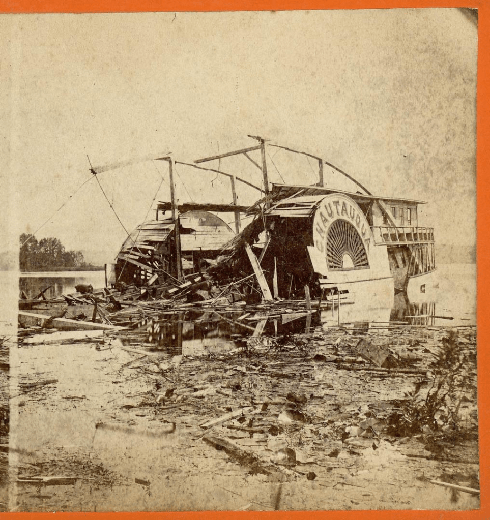
The wreck settles into the water. The stern remains afloat, typical for wooden steamers. The bow is a shattered ruin. The lake is a boiling, smoking patch of chaos.
Aftermath
The Chautauqua was towed back toward Mayville. The newspapers called it “the most dreadful calamity ever known upon our lake.”
The Wrecked Steamer Chautauqua
The final toll varies depending on the source, between five and eight dead, many more injured. For a small community in 1871, it was a staggering blow.
The Chautauqua is the only major boiler explosion on the lake’s record.
“In the world of Stones, every landscape is a canvas for adventure. From the soft, shell-strewn sands of beaches to forests blanketed in pine needles and twigs, to the manicured charm of mowed meadows and diverse soil terrains – diversity is our playground. We embrace the unconventional, where slopes, hills, and rugged cliffs become the backdrop for an exhilarating Stones experience.”
Stones Throwing Association Website
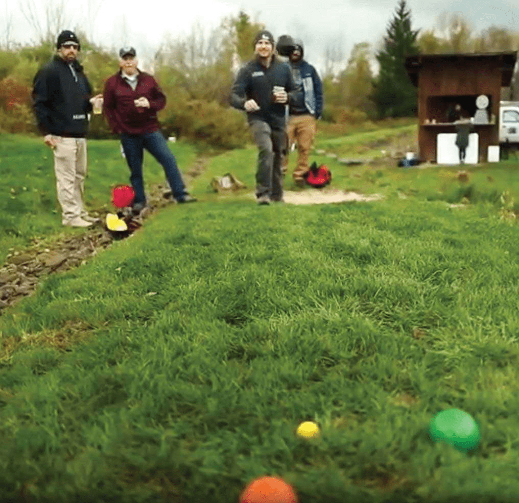
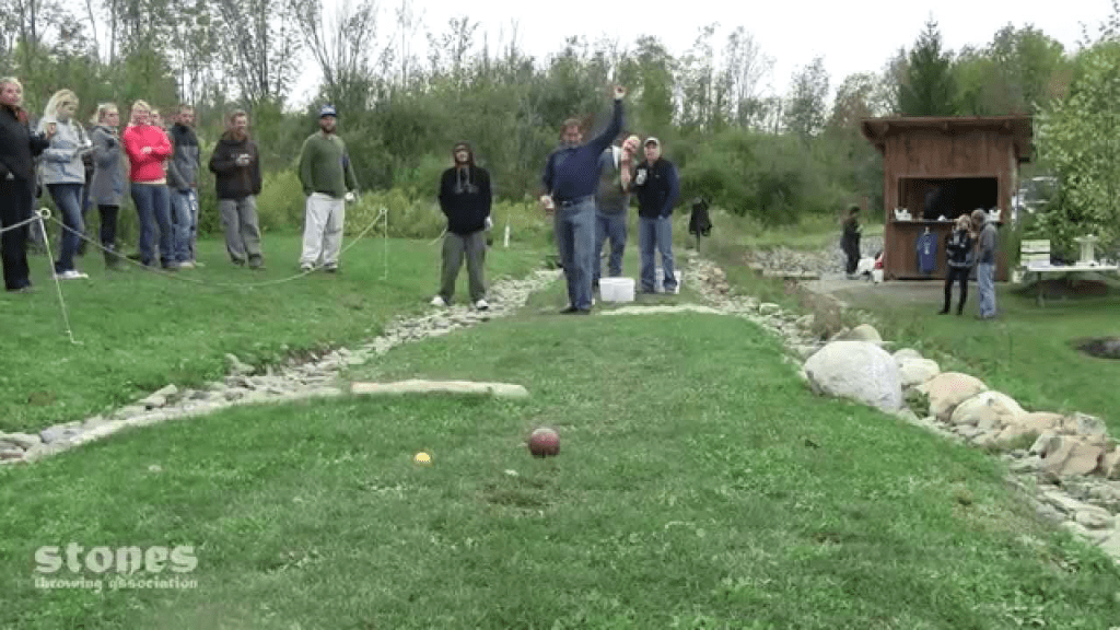
The game of Stones is easy to describe and hard to picture. The nearest recognizable relative is probably bocce; a small ball is set on a fixed piece of earth, and alternating competitors toss heavy baked-clay balls at the target, trying to get closest. But it’s like bocce in the same way shuffleboard is like golf.
So, Stones is more like golf? Not exactly. It has elements of golf, in that there is a fixed course, with fairways and hazards, out of bounds, and management strategies. But it’s more like putt-putt blended with bowling than the golf you know.
Kade Sivak is the COO of the Stones Throwing Association and manages the course located at the Southern Tier Brewery in Lakewood. It’s a unique recreation operation in Chautauqua County. He says about the game, “What I love most about the game is that it’s accessible, it can be played by people of all ages and still have a great time. We’ve had a tournament where we have an eight-year-old partner with an eighty-year-old and they ended up winning a few games and had a great time.”
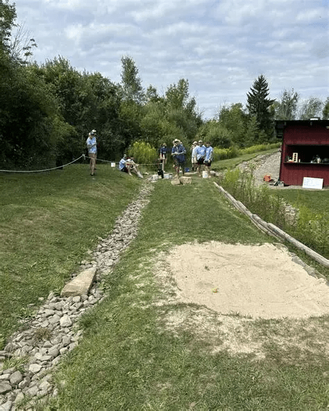
A Stones course is five stretches (holes) that take you through mowed fairways, sand traps, and rough patches, around and through trees and stone fixtures, up and down hills. There are clear boundaries on each stretch (sometimes it’s a pool of water!). You play the five stretches, tossing four stones per round -some stretches remind you of golf par threes, some are longer and remind you of a par five. All stretches score the same, you throw your stones, score the stretch and move onto the next, unique challenge. There are sixteen basic rules of play and etiquette, but like golf (which has only a few rules), it’s the interpretations that are abundant…especially when you take balls of any sort into the wild and toss or hit them around.
There. Simple.
And, in Lakewood, it’s played in a beer garden. What could be better than that?
Kade manages the Southern Tier course called Brewers Hollow. “I manage all events like leagues and tournaments there,” Sivak says. Brewer’s Hollow is the first public stones course ever built, constructed by Sivak Stonemasonry. “They work as a course designer and builder for any new courses at other breweries or businesses that want to enjoy the game of Stones. We encourage people if they ever see a place that could fit a Stones course to check out our website and reach out to us so we can attempt to make that dream come true!”
Brewer’s Hollow is the premier Stones venue in, well, the world. “We’ve hosted hundreds of tournaments as well as leagues every summer and fall that fill up quick, but we are always looking to expand and host more players each night,” Kade says. “We have a world championship every year, with last year’s having a cash prize of $1,000. This year we are attempting to take it to the next level and really give people the best experience at each tournament that is planned out this year.
“STA tournaments and leagues are on the website that vary in competitiveness. As well as a team league called the National Stones League, that includes teams like the Buffalo Mafia, the Jamestown Ironmongers, Chautauqua Armada, and the Pittsburgh Chaos. This team league is peak competition as it is a different approach to the game but takes all the best players and faces them off in 8v8 competition.”
Play at Brewer’s Hollow, like most outdoor sports in the area, follows the weather. Kade continiues, “For casual play we will be opening up May 18th on Southern Tier Public Day where we will be offering each new players first game free as well as have the option to have a skilled player help them learn the game. Then we’re open Wednesday through Sunday until the end of September.
“We’re promoting this year as ‘The Year of Stones’, so if you’ve never played, this would be a good time to come try out the game. It’s easy, fun, and doesn’t take long to play a match. The Stones community is filled with great people that are always willing to help teach new players and it’ll be the best outdoor activity in the area.
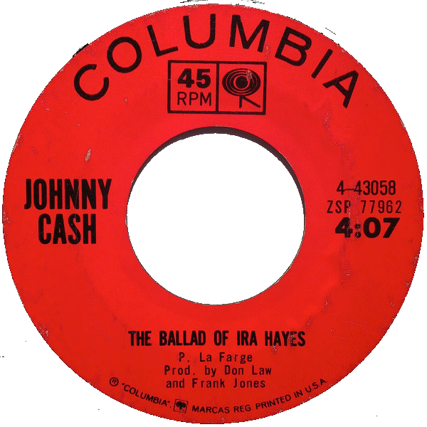
I wrote a piece for THE VILLAGER MAGAZINE (find it here: https://thevillagerny.com/) aboout The Kinzua Dam Project and Johnny Cash’s song “As Long as the Grass Shall Grow.”
Doing the research for the article I contacted Mark Stielper, the historian at THE JOHNNY CASH MUSEUM.
Mark sent me the letter below…it doesn’t have much to do with Kinzua Dam, but it is a nice historical look into Cash and his involvement with the Seneca Nation.
Enjoy the read.
Bill,
Your piece is about Kinzua, not Cash, but I will give you a brief narrative of the latter, and you can cull at your discretion.
Peter La Farge wrote “The Senecas” (the original title of “As Long As…”) in 1962. He was a folk singer and activist. One of his haunts (and where he would die in 1965 at age 33) was Greenwich Village, the scene of his intersection with Johnny Cash. Both men recorded for Columbia Records and, pivotally, they discovered that each had Indian heritage. (They were both mistaken in this understanding of their respective lineages, but at the time, it was a powerful self-identity.)
La Farge’s first album for Columbia was called “Ira Hayes” and Other Ballads (Author note: “The Ballad of Ira Hayes” was successfully covered by Cash and Bob Dylan). It wasn’t really a protest album, but he soon assumed the role of spokesman for Native issues. He was abrasive, caustic, loud and generally unpleasant, which did not serve him or the cause well, and he fell out of favor with his fellow protesters (most of whom were into the civil rights arena anyway and found Indian matters passe).
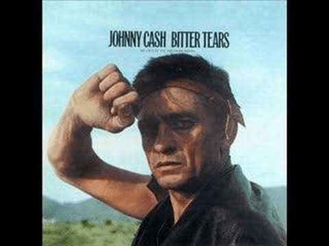
But La Farge and Cash were birds of a feather, “Indians in the white man’s camp,” as it were. The two fed off each other, but Cash grew more prominent and influential, particularly after his huge hits, “Ring of Fire” and “Understand Your Man.” He became obsessed with the stories of Ira Hayes and the Seneca chief, Cornplanter, via La Farge’s accounts. Cash actually visited Kinzua–he would go on these on location missions frequently–and put “As Long As the Grass Shall Grow” as the first track on side one of the Bitter Tears album.
Now, historical accuracy must trump fanciful legends. It is not true that Columbia refused to release the song. It was 1) not a new song and there was no reason to hide it and 2) as pointed out, it had prominent placement on the album.
Although “The Ballad of Ira Hayes” was the single release, Cash remained committed to the Seneca song, often pairing the two in performances, including on his network TV show. The line, “Cornplanter, can you swim?” would be a biting counterpart to “the ditch where Ira died” in personalizing the legacies of the two Indians in a way that La Farge’s scattered screeds could not.
Let me know how I can help you deliver on your mission.
Me and my friends track snow through the front door, up the stairs to the second floor. “We’re playing.”
“Why are you in the house? You’re making a mess!” My mother closes the door against the snow that drifts into the living room, knuckles on hips, lip pursed. “And you’re letting the heat out!”
I stop in my tracks. I know that tone. It’s the “Turn off the lights, do you work for the electric company?” “Eat your dinner, kids somewhere are starving.” “If you’re friends jumped off a roof, would you?” voice.
Those friends (who I’d naturally follow off a bridge) run into my bedroom on the second floor, throw open the window that overlooks the porch roof, and climb out.
“Mo-om… we have to jump from up here. The snow’s too high.”
“You’re jumping from…upstairs!?”
“The roof.”
“The roof?”
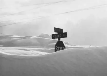
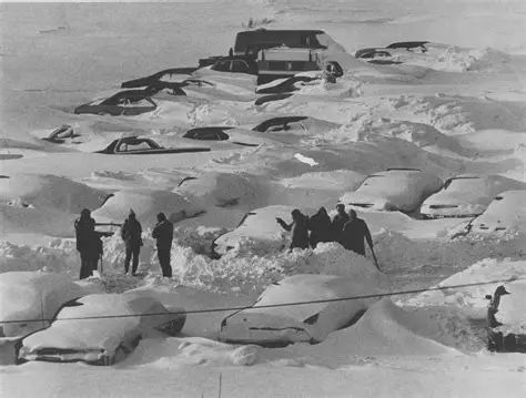
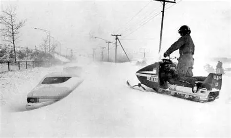
You’re a kid and you don’t have to go anywhere or work a shovel -except to build snow forts and uncover your sled. So, you wrap up in as many layers as your mother can load on you, and you go outside and play, comfortable in the fact that you’re allowed to come right back inside when your fingers and toes turn blue and your runny nose freezes in your scarf. When you’re a kid, a blizzard is a trip through a Narnian wardrobe. It’s not a lethal weather distaster.
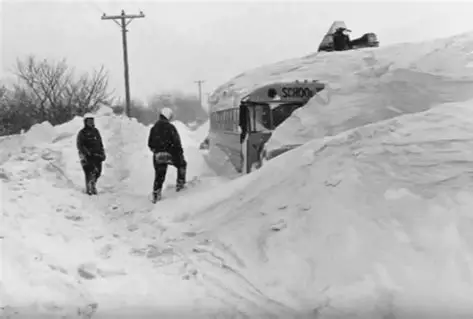
The blizzard of 1977 was a catastrophic weather event for western, New York. Twenty-eight people died from exposure, entrapment and vehicle incidents. Highways and airports shut down, stranding thousands, keeping commerce and emergency aid from moving anywhere. Homes were buried in forty-foot drifts, outages and blocked roads created shortages. There were significant livestock deaths and agricultural losses. Anything that needed to be delivered (especially milk from local dairy farmers) wasn’t. Power failed. Remote areas were cut off for days.
Buffalo took the brunt of the storm, but the entire southern tier was burdened by the wall of white that spent three days dumping snow. The snowfall amounts had been (and has been) matched, but the combination of freezing temperatures and unpredictable winds were incomparable.
Some thirteen-thousand people were stranded in Buffalo, ten-thousand cars abandoned. Snow mobiles became the only viable, reliable mode of transportation, but even these had to be limited when they ran into covered vehicles, then building tops, then power lines.
Staying inside and riding the storm out, without a plan, was dangerous as well. Houses were covered, with no way to vent noxious fumes that built up from heating systems, strangling utilities.
The city of Buffalo dominated the national narrative of the blizzard. Chautauqua and Cattaraugus Counties experienced the storm the same, on a miniature scale, smaller populations, with corresponding resources. Both counties rely heavily on a network of rural roads and state highways, most notably Route 60 and the New York State Thruway (I-90). Within hours of the storm’s onset, these arteries were clogged with abandoned vehicles. The storm warranted a complete ban on driving, but the independent and rural character of the population made many people try to commute. It quickly became impossible. Motorists, blinded by whiteout conditions, drove into ditches or simply stopped in the middle of a road, buried in drifts. Sheriff departments and local police had to recue people in vehicles that weren’t much more mobile than the stranded cars. They were overwhelmed. For days, the only functional vehicles were heavy military equipment and private snowmobiles, delivering medicine and food.
A federal state of emergency was declared -the first time ever for a snowstorm, and over five-hundred national guardsmen were deployed to Buffalo and surrounding towns. The Blizzard of 1977 set the standard for snow-related catastrophic emergency response protocol throughout the United States, specifically the severity and seriousness of bans on driving in affected areas.
My dad eventually brought a ladder to the yard, and we climbed to the porch roof from outside. We were kids with a week off school, jumping in piles of snow. We didn’t know we were in the middle of the Blizzard of 1977.
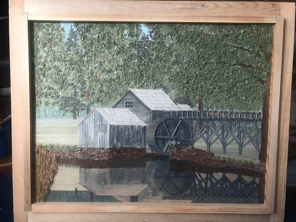
He looked at the natural world differently than me and you, most probably, with an artist’s eye. You could tell then -if you saw him cruising the lake shoreline attuned to driftwood, touching trees for texture, skimming wood scraps of fallen lumber for the right shape, the perfect color or grain- that he sought something we didn’t see.
You can tell now by the collection of bark, pebbles, and myriad species of flora stored at the house of his protégé, Greg Wefing.
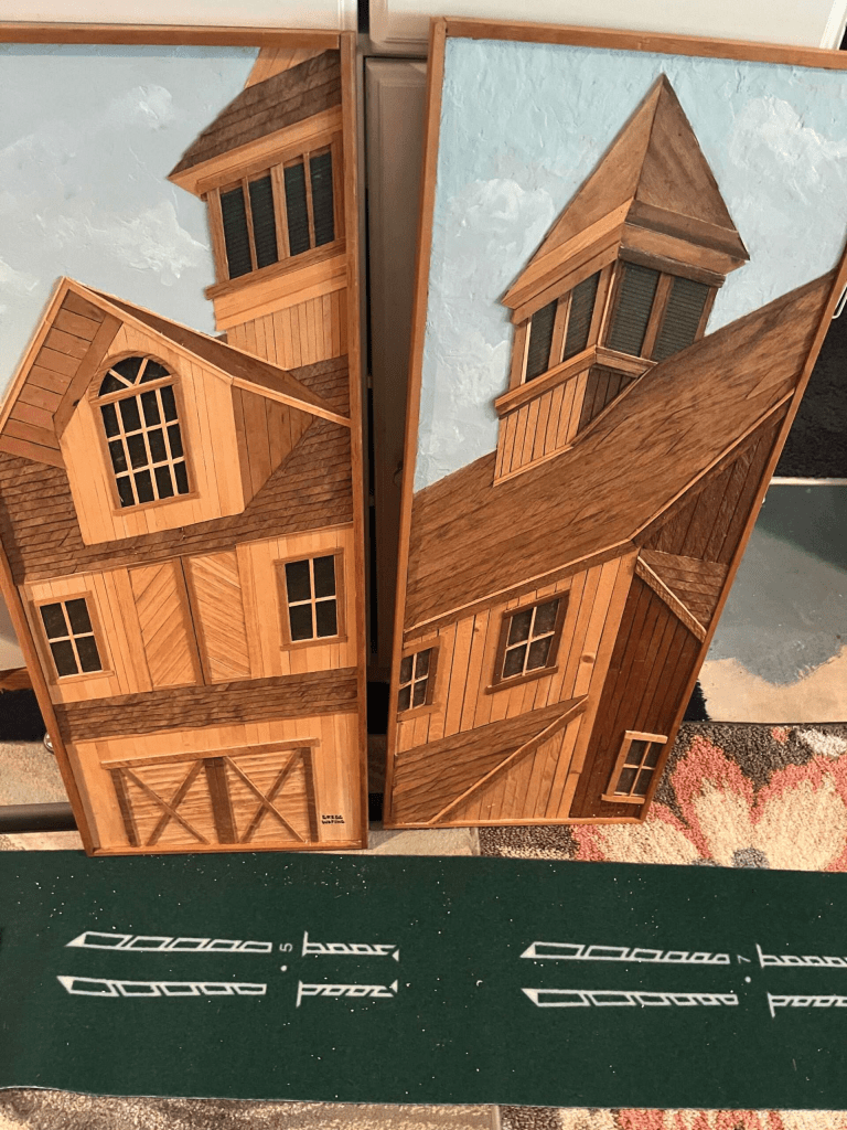
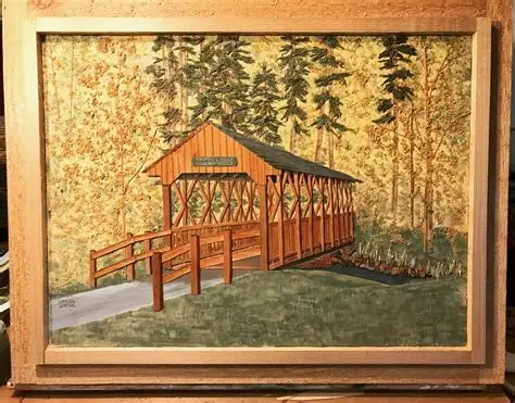
Cecil Rhodes has been gone for some eleven years now, passed away in 2013. He was a schoolteacher at Maple Grove High School, classically trained in industrial design at the Pratt Institute of Brooklyn, and at teaching at Edinboro University of Pennsylvania. He was also a local legend and celebrated creator of what he called then, and Greg calls now, Woodscape art.
Woodscapes are crafted with different sizes and various species of wood sometimes enhanced with colored stains and paints. They are like three-dimensional paintings. Greg has a collection of his own work, and a few of Cecil’s pieces as well. A Woodscape of Wefing’s has hung the Bemus Village Hall for about thirty years.
Rhodes essentially invented the discipline of Woodscapes in the late 1970’s and early 80’s. He’d been employed in the garment district of New York City for eleven years, a teacher for five more at Maple Grove (his de facto alma mater, graduating from Bemus Point High School in 1950), and a boat repair specialist when he realized he had an aptitude for art, and that wood was his medium.
“Cecil created from his imagination, I think. He’d get an idea and be able to make a piece. I do mine from pictures I find, usually in calendars and magazines.” Wefing is standing in front of a pile of nature-art planners and mags on a workbench in his basement workshop. Lining the wall are shelves of wood strips and filings of various color and texture. “Something will kind of jump out at me, and I’ll have a new project.”
And then he goes to work, unearthing the raw material that will form his art. Greg is now the person you’ll find in the Bemus area combing the natural world for the right materials to fulfill a vision and build Woodscape art. “Yeah, I’m the guy you see cutting down tall grass or cattails on the side of the road. Or at the lake looking for driftwood, peeling bark off a tree,” he says.
The village of Bemus Point, when you drill down to the locals (that population that spends years in the same place, completing their routines, season after season) is character driven. Cecil Rhodes was semi-famous for his meticulous, detail-driven artwork. Wefing has followed a similar path, building a trove of bas relief art that’s impressive for its detailed craftsmanship and vision. “I worked for Cecil for two or three years while I went to art school,” he says. “Cecil worked mostly with wood tones. I started to add some color to mine. They’re a little different, but a lot of the same techniques, the same process.”
Wefing figures he could knock off a piece in a week if he put in the hours. But he does his art at his own pace. “I usually do about five a winter, down here in the studio, when the weather is bad. I’ve done commissioned work, but don’t really like it. I like to work at my own pace, on my own projects.” He says Cecil’s efforts to mainstream the art wasn’t as successful as his individual creations. “He was thinking we might mass produce some of his pieces, and I was going to be part of that. It never really worked out. His art was pretty special.”
Wefing isn’t really in it for the money (though he could be, his work is that good), but does sell his art, informally, and mostly from his Facebook home page.
The paranormal expert/examiner/medium/TV personality steps boldly into the house/barn/cellar/church, the one that locals say is haunted, the site that bumps in the night. An audio-visual crew follows diligently. They pack equipment designed to detect the undetectable, to record the mysteries within; a ghostly apparition, a supernatural aura, a sixth sense.
And…CUT
PRINT
Mason Winfield has a deep and abiding interest in the paranormal. It’s been his life work (as evidenced by his vitae on his website http://www.masonwinfield.com). He’s a lecturer, author, storyteller, scientist. He is not, by his own reconning, a “ghost-hunter.” If there’s a profession that informs and directs his attention and talents, it’s probably best described as “Truth Seeker”.
He believes it’s time for the industry to innovate, to broaden its influence. “If there’s a possible way to the truth, you have to take it, don’t you?” he says.
To accomplish this, Winfield seeks to employ a field of multidisciplinary professionals, people different in cultural and thematic sensibilities, to explore ancient spaces, areas of the northeastern United States that have universally experienced what he calls “EHE”, Exceptional Human Experiences. “Why do people say they see the thigs in the paces they do?” Winfield asks.
It’s a query he hopes to answer with The Spirit Way Project.
Designed like the popular European group The Dragon Project, The Spirit Way uses the resources of scientific and paranormal disciplines to research the undeniably interesting and real world of EHE.
Winfield says, “The reality-TV paranormal industry typically studies buildings no more than a century-old–as though haunted sites are sensational and rare, no more original ones can be found, and paranormal sightings occur only indoors. It also barrages us with two perspectives, either intuitive–psychic–insights or surveillance ghost-hunting, as though using electronic and digital instruments as a glorified Ouija board is some objective avenue to the truth–and no other avenues of insight are available.”
Differentiating from the television shows you night have seen, The Spirit Way is basically a two-fold approach to supernatural investigation; using ancient resources to identify sites of EHE that have survived and inspired humans for centuries (think Native American history and collective consciousness), and to coordinate with any and every discipline to develop a coherent and multi-faceted theory of those experiences. So far, the group has employed:
A Feng-Shui Master, an Algonquin Elder, an African-American psychic medium, an author/researcher/paranormalist, a psychologist, two master dowsers, local scholars, historians, anthropologists, geologists, First Nations leaders, aerial surveillance experts, and team of paranormal investigators.
The goal of the team is to examine sites of reported Exceptional Human Experiences through the disciplines of geometry, shape (symbolic form), geology (earth-energies), archaeo-astronomy (an awareness of sunrises, moonrises, equinoxes, and solstices), and alignments across broad stretches of landscape to suggest codes if not messages.
“It’s been a challenge. There are no upstate surveys of supernatural events; national, but not local. All anyone can agree on is that these monuments had sacred function–and that, like Stonehenge and the Great Pyramid and a worldwide league of others, they are paranormal sites. In their proximity, people report exceptional experiences. Just like a haunted house–though vastly grander and more profound–these ancient American sacred sites get a lot of ghost stories.”
Winfield lives in East Aurora, and understands the newer supernatural phenomenon in Western, New York. Along with his partner, and co-founder of The Spirit Way project, Algonquin Elder Michael Bastine, who Winfield calls one of the best teachers in the world on the subject of native supernatural history, the goal is to broaden the scope of their studies to the ancient world.
“The ancient monuments of the British Isles have been preserved and studied,” Winfield says,” We want to start a new model of north American haunted sites, ancient places, not buildings, hut rather the outdoor sites, real study from different perspectives.”
The Spirit Way will start with a program of fifteen YouTube episodes in New York State.
Winfield concludes, “There is more to the paranormal. The Spirit Way Project (SWP) believes it’s time for a revolution. We think the public thirsts it.”
A cultural question of stereotypes and branding for you.
A while ago Quaker Oats and Mars Inc. rebranded their two most iconic brands, Aunt Jemima, and Uncle Ben in direct response to the 2020 George Floyd choking tragedy. The legacies of those brands are both widely considered to be Antebellum representations of slavery (calling freed slaves aunt and uncle was a way to avoid having to call them Mr. or Mrs.). The trademark pictures evoke vision of blacks as servants, Jemima in a scarf, Ben in a bow tie. Removing those characters from public consumption, can be considered a reasonable reaction.
It doesn’t seem complicated, but it is. The topic is incredibly nuanced. But I do believe the discourse surrounding the controversy can raise some pointed questions for reasonable discussion. My thoughts, admittedly brief in the lines I here, are these.
-Does the statute of limitations run out on racial stereotypes? I have a solid sense that those icons have historically dubious implications. But my children don’t. Their children won’t. To them, the characters on the box mean pancakes and something they don’t like for dinner (rice); they are vague pictures on packaging that triggers the idea of quality. Do we who know the story have an obligation to relate what those icons might mean? To what end?
-Is racism, or bigotry a deeply personal thing, or can it be the purview of another person or body politic. Can you outsource offense? Isn’t that a mild form of bigotry in itself?
What if bigotry against me (in my case, think ageism) doesn’t bother me but offends others. In that case, what do I owe my station (my old brothers and sisters)? Should I pre-empt intolerance that might some day affect me? Do I need to get involved? If so, when, and for whom? Do I owe that feeling of offense to other groups that are discriminated against?
-The Aunt Jemima and Uncle Ben’s brands (along with others like Cream of Wheat, and Mrs. Butterworth’s), have for years been accused of using racial stereotypes to sell food. It shouldn’t have taken Floyd’s murder, caught on camera, for Quaker Oats to decide their brand were racially nuanced.
I assume multi-billion-dollar corporations follow paths of least resistance for the sale of their products; they rarely set cultural or moral ideals, they follow them in the market. Changing the logo on a brand, and claiming it has something to do with a social contract, while possibly coincidentally true, isn’t a driving force for such a business transaction as the sale of food product. Quaker Oats and Mars, Inc. didn’t change logos because those icons had basic racial overtones. They changed because they believed it would sell more syrup and oats to more people (or at least that they’d sell the same amount and get some publicity and social credit in the balance).
But what if the face of that brand doesn’t believe that the brand they represent is a racial offense, or that at least a discussion about it is warranted?
The family of the Lillian Richard, who portrayed Aunt Jemima, has a different take. While they support the Black Lives Matter movement that generated the brand change, they would still like to celebrate the idea that their ancestor played an important part of history.
“All of the people in my family are happy and proud of Aunt Lillian and what she accomplished,” says Vera Harris, Richard’s niece. “Erasing my Aunt Lillian Richard would erase a part of history.”
In the case of Quaker Oats, the Harris family has an idea that would satisfy a desire to maintain the legacy of their aunt, and to deliver a message of education and reverence to the women who came before her. They suggest a commemorative box to recognize the many women who portrayed Aunt Jemima over the years. A box that would include a photo of her aunt dressed as Aunt Jemima with the scarf, along with a photo of Richard looking like herself to show people a complete picture.
Seems like asking the people involved is a good place to start.