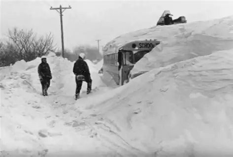
When she blows it is a geyser of wood, iron, and human flesh spouting from the lake, reaching into the August sky, a China Syndrome meltdown of boiling water and steam that kills between five and eight people (steamboats are like busses, you pay your fare as you board) and ruins many more.
Steamboat service on Chautauqua Lake began as early as 1828. By the 1870s, it had grown into a regular, reliable system of travel, a transportation corridor before it was a recreation and entertainment resource; that designation began in the 1890’s when Celoron became “the Coney Island of Chautauqua”.
The lake WAS the highway in 1871. Roads from Jamestown to Bemus or Stow, on to Mayville, were rutted dirt horse-paths. If you wanted to move any significant quantity of livestock, mail, food, timber, or people, you did it on boats like the City of Buffalo, City of Chicago, City of New York, and City of Erie. Competition was fierce, and companies often upgraded engines, cabins, and décor to attract passengers. Consistency, timely delivery of patrons, keeping to a schedule was important to the lines.
A man steps out of an Atlantic & Great Western Railroad passenger car at the station in Falconer, New York. In 1871, travelers going from Buffalo to Jamestown, ride the “A&GW” on a broad-gauge six-foot line, the only through service connecting Buffalo to the southwest most corner of New York (Buffalo to Hamburg to Gowanda to Dayton to Conewango to Kennedy, to Falconer).
Service on the Buffalo & Jamestown Railroad won’t reach into Jamestown until 1875. Freight interchange that far is limited because of the gauge mismatch, lines going into Jamestown are smaller at 4 foot 8 1/2 inches.
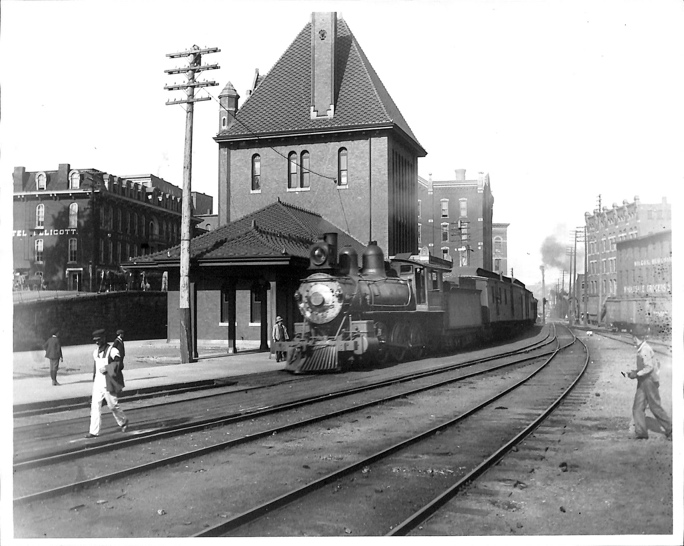
The first direct standard‑gauge rail line into Jamestown
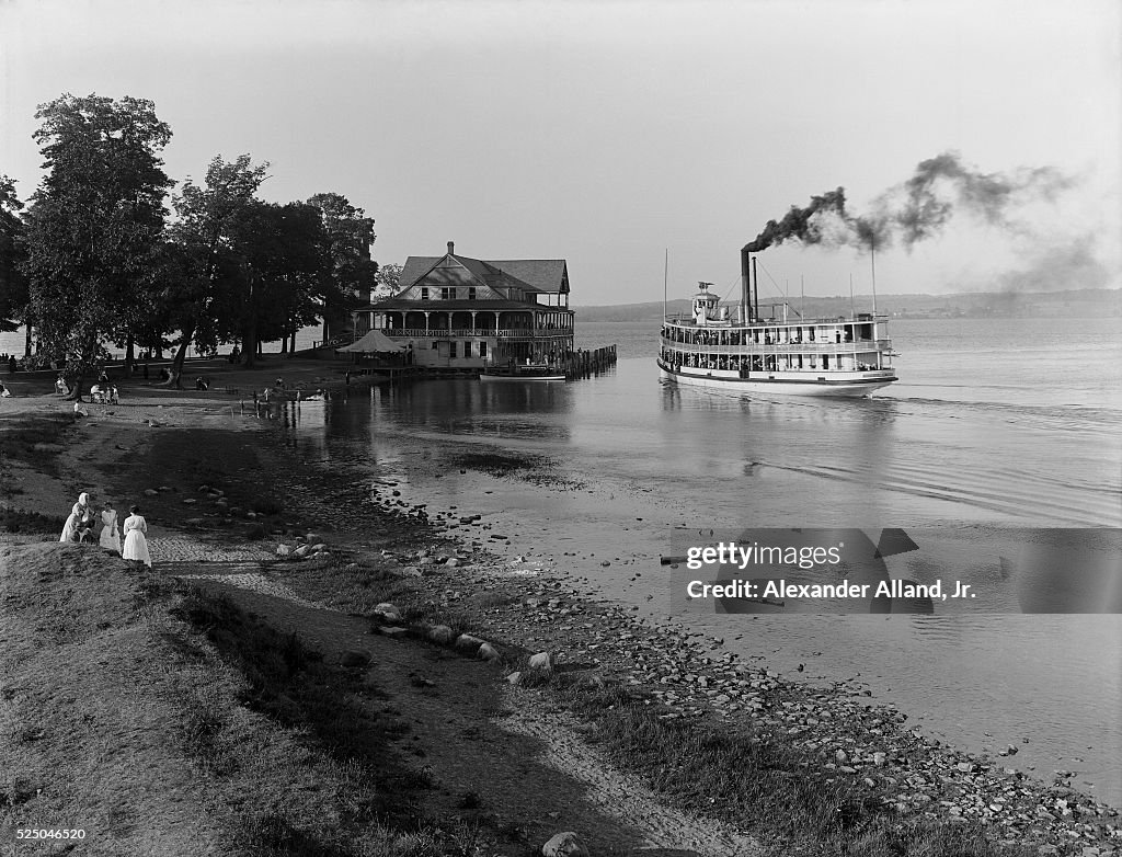
The man hails a carriage to Burtis Bay, named for settler Joseph Burtis -later the area is called Prendergast Point, eventually named Celoron when the city is incorporated in 1896.
The Docks at Celoron, New York
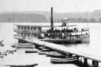
Despite temperatures near ninety degrees, he wears the dark frock coat and light patterned waistcoat of a traveling gentleman, checked trousers with suspenders. He tips his bowler cap to the ladies, checks his pocket watch and hurries to the docks. There he pays his thirty-five cents (an extra five cents for his traveling trunk) and boards the Steamer Chautauqua for a refreshing ride to the upper basin of the lake where he has a farming interest.
The sixteen-foot paddles of the side-wheeler steamer (twelve, five-foot tall buckets built into each) engage and the Chautauqua lurches forward, churning up soot and weeds from the shallow Chadakoin inlet.
A sixteen‑foot wheel on a 120‑foot boat is proportionally large, nearly 14% of the vessel’s total length. That size gives the Chautauqua strong thrust to handle the lake’s shallow, weedy conditions, and good maneuverability for short hops between landings.
It also puts a considerable burden on the boiler that powers the boat.
A young man climbs to the main deck to get some air. He’s just finished feeding the boiler, third load of wood in the last half-hour on orders from the captain. This captain likes speed, likes being ahead of schedule.
It’s too much wood in the young man’s opinion, runs the boiler too hot, but he isn’t about to contradict the captain, this only his second week on the job as boilerman on The Steamer Chautauqua.
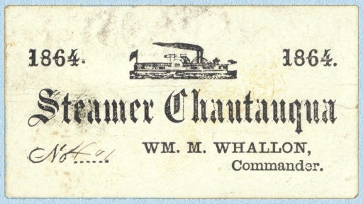
The Chautauqua was retrofitted the beginning of summer, 1871, when the Chautauqua Paddle Wheel Company took ownership of her. New paint, new benches for passengers, a new hurricane deck, and a new boiler. New boilers need to be broken in, tested against the haul of the paddle in different conditions, heat levels meticulously maintained and monitored to see how the steamboat reacts and responds. The new boiler on The Chautauqua is no exception.
Except with the summer season here there’s money to be made, people need transportation up and down Chautauqua Lake. They can’t wait -won’t wait- for a boiler to be tested. Sometimes, those concerns outweighed safety protocols, and that could prove to be catastrophic.
As the young, inexperienced (cheap summer labor), boiler boy stands on the deck, sucking in the humid August air, something is happening three decks below.
PART II
Steamboat service on Chautauqua Lake began as early as 1828. By the 1870s, it had grown into a regular, reliable system of travel, a transportation corridor before it was a recreation and tourist resource.
The Steamboat Chautauqua lurches from its moorings in Burtis Bay (ne Celoron) and chugs into the lower basin of Chautauqua Lake. The captain is anxious to make good time and calls down to the boiler room for more power.
The Steamer Chautauqua Loaded for the Trip Up-Lake. To increase speed, the boiler crew throws in a heavy charge of wood. This spikes the furnace temperature. Pressure begins to climb faster than usual.
A gentleman watches a young man spring from the engine level onto the hurricane deck. The teenager sucks air and leans over the rail.
“Hot down there?” The man lights a pipe.
“Yes sir. We’re running a new boiler and the captain wants speed.”
“Makes for a nice breeze.”
“Yes sir,” the young man frowns, gazes at the shoreline. “Speed means a hot boiler though.”
The Chautauqua pulls into the narrows at Bemus Point. Farmers and merchants disembark. Mail bags and crates of produce are unloaded. Seven cords of lumber are dropped off while passengers board for the next leg of the trip to the northern basin of the long lake at Midway.
The Steamer Chautauqua Pulls into the Docks at Bemus Point
The sixteen-foot-tall paddle wheels idle in the shallows. A young man approaches the captain.
“Sir, when we sit still the boiler runs very hot.”
“That’s good lad. Plenty of steam to finish the trip to Mayville. We’ll break our own record! Hold until we depart and load the rest of the wood into her.”
“Aye aye sir.” The boy heads back belowdecks, shaking his head.
A gentleman overhears the conversation, watches the boy return to the boiler. He collects his traveling trunk and moves to the stern.
The Steamer Chautauqua Departs Bemus Narrows
The waterline on the new boiler behaves differently than the old one, and the engineer on duty misreads the pressure gauge. When pressure rises to this level, the pump can’t keep up feeding cool lake water into the boiler. The crown sheet, the top of the firebox, overheats. It goes from hot, to red‑hot, to soft. Pressure rises above the boiler’s comfort zone. The overheated crown sheet is now the weakest point in the system.
Pressure spikes as The Chautauqua rounds the tip of Long Point.
A surge of water kicks up from the punishing paddle wheels, splashes onto the red‑hot crown sheet, the hissing can be heard on the main deck. There is an instant of flash‑steam, and the softened crown sheet collapses.
A gentleman at the stern of the Steamer Chautauqua hears a hissing from below-decks. He removes his jacket and waistcoat. He puts his wallet, papers, and pocket-watch in his luggage trunk, hoping it floats.
Just past Prendergast Point with the shoreline sliding by and passengers relaxing on the upper deck, the boiler shell ruptures. A blast of superheated steam, shrapnel, and scalding water rips upward and outward. The explosion makes a violent tearing sound.
Passengers on the upper deck are thrown into the air. The pilot house collapses. The midsection of the boat disintegrates, and a column of steam and smoke shoot straight up like a geyser. The paddlewheel jams. The Chautauqua begins to list immediately.
A gentleman waits a beat, then two. Then he tosses the trunk into Chautauqua Lake and follows it into the warm summer water.
Passengers are thrown into the water where they cling to floating wreckage. The stern stays afloat, but the bow is a splintered ruin.
Nearby fishermen and rowers rush toward the screams. Boats from Long Point reach the wreck within minutes and pull in the burned, the stunned, and the bleeding.
Several passengers never surface.
The wreck settles into the water. The stern remains afloat, typical for wooden steamers. The bow is a shattered ruin. The lake is a boiling, smoking patch of chaos.
Aftermath
The Chautauqua was towed back toward Mayville. The newspapers called it “the most dreadful calamity ever known upon our lake.”
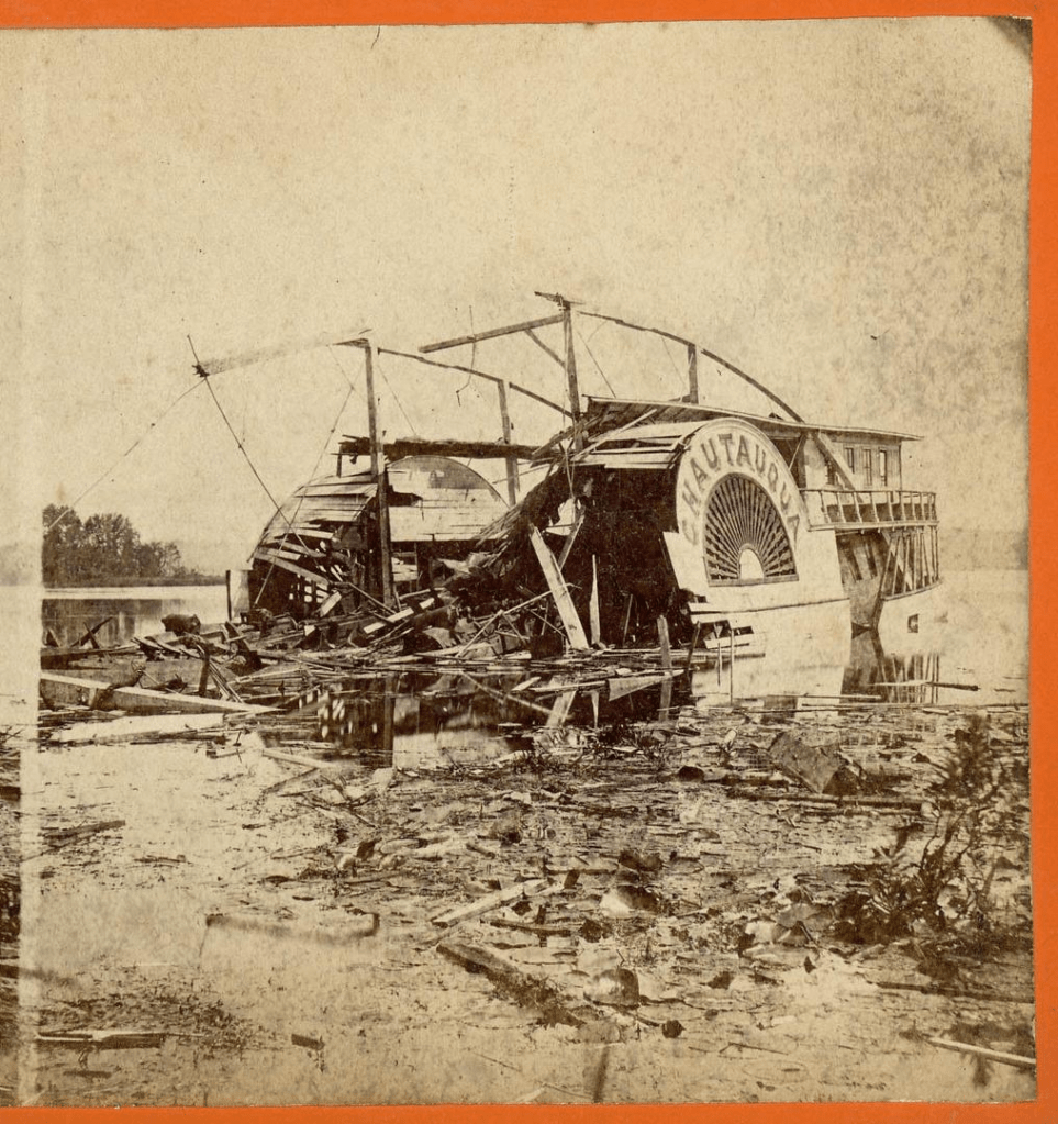
The Wrecked Steamer Chautauqua
The final toll varies depending on the source, between five and eight dead, many more injured. For a small community in 1871, it was a staggering blow.
The Chautauqua is the only major boiler explosion on the lake’s record.